Sailing the Cape of Good Hope is the moment every ocean passage-maker talks about before they ever go near it. The reason is one hard fact: the Agulhas current can run at up to five knots of warm, fast water down the African shelf, and a southwesterly gale can roll straight up the South Atlantic and meet it head-on. That collision, not the geography, not the name, not the Cape itself, is why sailors respect this piece of water. Agulhas current sailing is its own branch of seamanship.
This article covers the four things you actually need to understand before you round the Cape: how the current works, why wind against current builds monster seas, how to choose a weather window, and how a tall ship plans the passage differently from a yacht. It is written for the crew joining us on Leg 4 of the 2026 world voyage, and for anyone trying to make sense of what a Cape rounding really involves.
Planning your own leg? The full 2026 world voyage is live, browse the 2026 voyage and pick Leg 4 if rounding the Cape is what you came for.
On this page
- Why the Cape of Good Hope is hard to sail
- The Agulhas current, explained for sailors
- Freak waves, wind over current
- Weather routing: the only honest way round
- From Cape of Storms to Cape of Good Hope
- What Leg 4 looks like on the chart
- How a square-rigger rounds it differently
- FAQ
- Read also
Why the Cape of Good Hope is hard to sail
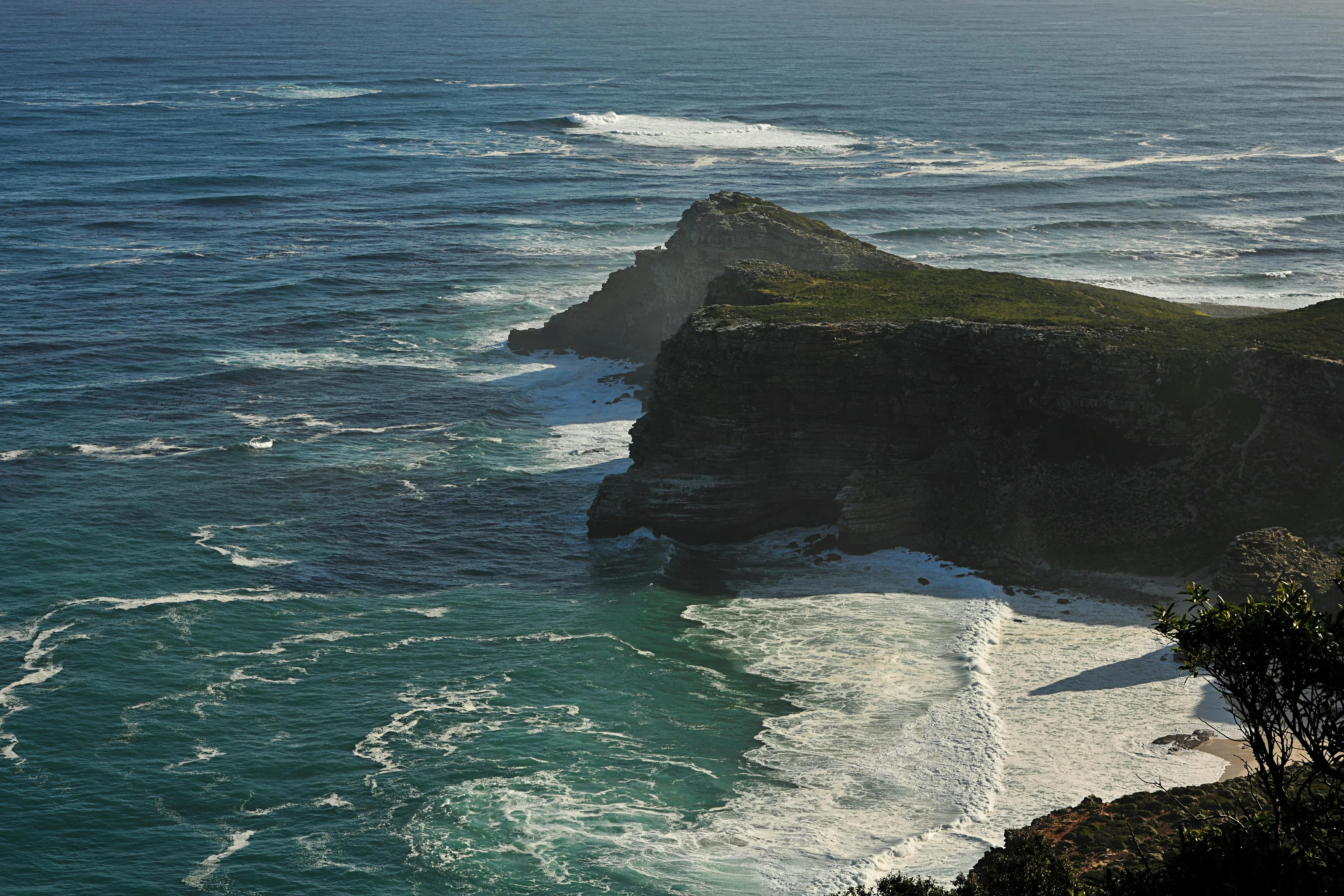
The Cape sits where two ocean systems meet. To the west, the South Atlantic, a fetch of thousands of miles across which low-pressure systems from the Roaring Forties steer north-east onto the African coast. To the east, the Indian Ocean, warm, tropical-fed, and draining south along the African shelf through the Agulhas current. The Cape is the choke point where both systems arrive at the same piece of shallow water at the same time.
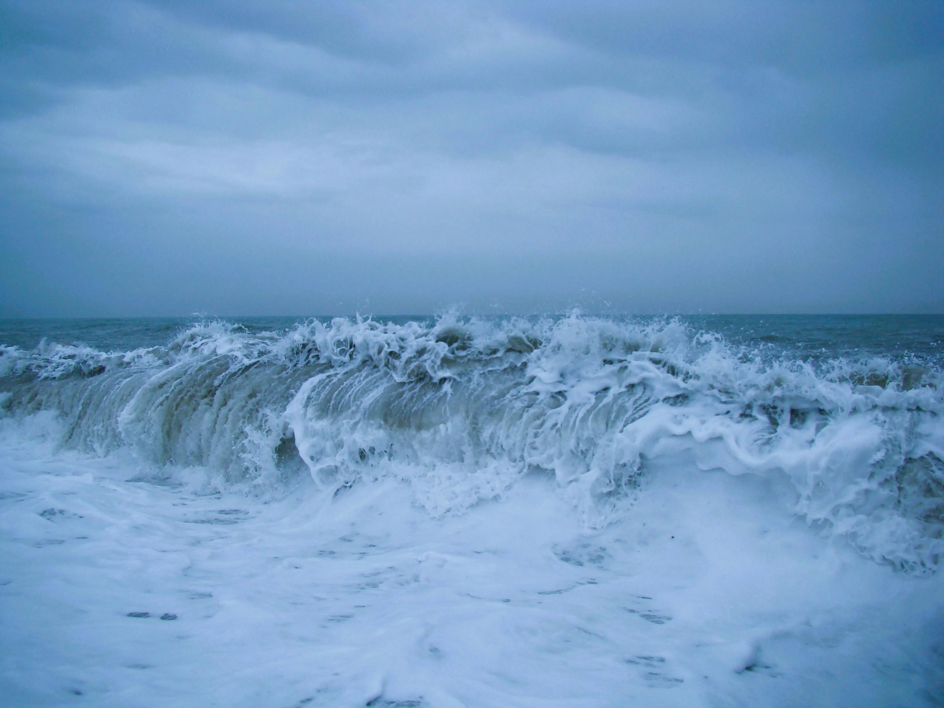
That is the first half of why it is hard. The second half is what happens when a southwesterly front, the back side of one of those South Atlantic lows, runs up the coast against a strong south-flowing Agulhas. The wind pushes a wave train one way; the current pushes the water the other. The swell steepens, shortens, and can turn vertical. It is the best-documented wind-against-current ocean in the world.
The physics is not exotic. Wind against current always steepens a sea. What makes the Cape special is the scale of both ingredients, a Southern Ocean fetch on one side, one of the two strongest western-boundary currents in the world on the other, and the fact that they are in direct opposition about a third of the time between May and September, and about one week in five even in summer.
Three ingredients of the Cape collision
The current
A warm, south-flowing western-boundary current, up to 5 knots in the core, fed by the Mozambique and East Madagascar currents, running along the African shelf.
The fronts
Cold fronts off the Southern Ocean swing north-east, arriving as SW gales on the Cape coast. A front every three to five days in winter, every seven to ten in summer.
The collision
When the SW front meets the south-flowing current head-on, swell heights do not add, they compound. That is the whole story.
The Agulhas current, explained for sailors
The Agulhas is not an academic abstraction. On deck, it is a thing you can feel. The water is three to five degrees Celsius warmer than the South Atlantic outside it, so the air over the deck is warmer too. There is a visible edge: a line where green-blue Atlantic water meets a darker, glossier blue, sometimes with weed and debris strung along it. When you cross the line, the sea state changes within a mile.
The core of the current runs along the shelf edge, roughly along the 200-metre contour, about 20 to 40 kilometres offshore between Durban and Port Elizabeth. Inside the core, peak surface speeds reach about five knots. The core itself is narrow, around thirty-four kilometres wide; outside it the current drops off quickly into counter-eddies. Net transport, the total volume of water the current moves south, is huge, of the order of a hundred sverdrups, a number that puts it alongside the Gulf Stream as one of the two great western-boundary currents on the planet. The Wikipedia entry on the Agulhas Current collates the oceanography if you want the sources.
For a sailor, the practical consequence is simple. Headed south with the current, you pick up a three-to-five-knot boost and the sea is smooth. Headed north against it, you lose the same amount and the sea is awful. On a Cape-bound passage from Durban we want to use it going south, then leave it as we turn west past Cape Agulhas. The Leg 4 itinerary covers the Durban departure in detail, it is the first tactical problem of the leg.
The signature weather
Wind against current, what it looks like
A southwesterly building against a four-knot south-setting current produces a short, steep, confused sea with breaking crests out of all proportion to the wind strength. The line between a clean ocean swell and this sort of water is often sharp enough to see from the helm. Knowing which side of that line you are on is the job.
The Agulhas in numbers
The 2026 season
Rounding the Cape is Leg 4
Four legs make up the first year of the voyage. Leg 4, Durban to Cape Town, is the Cape rounding.
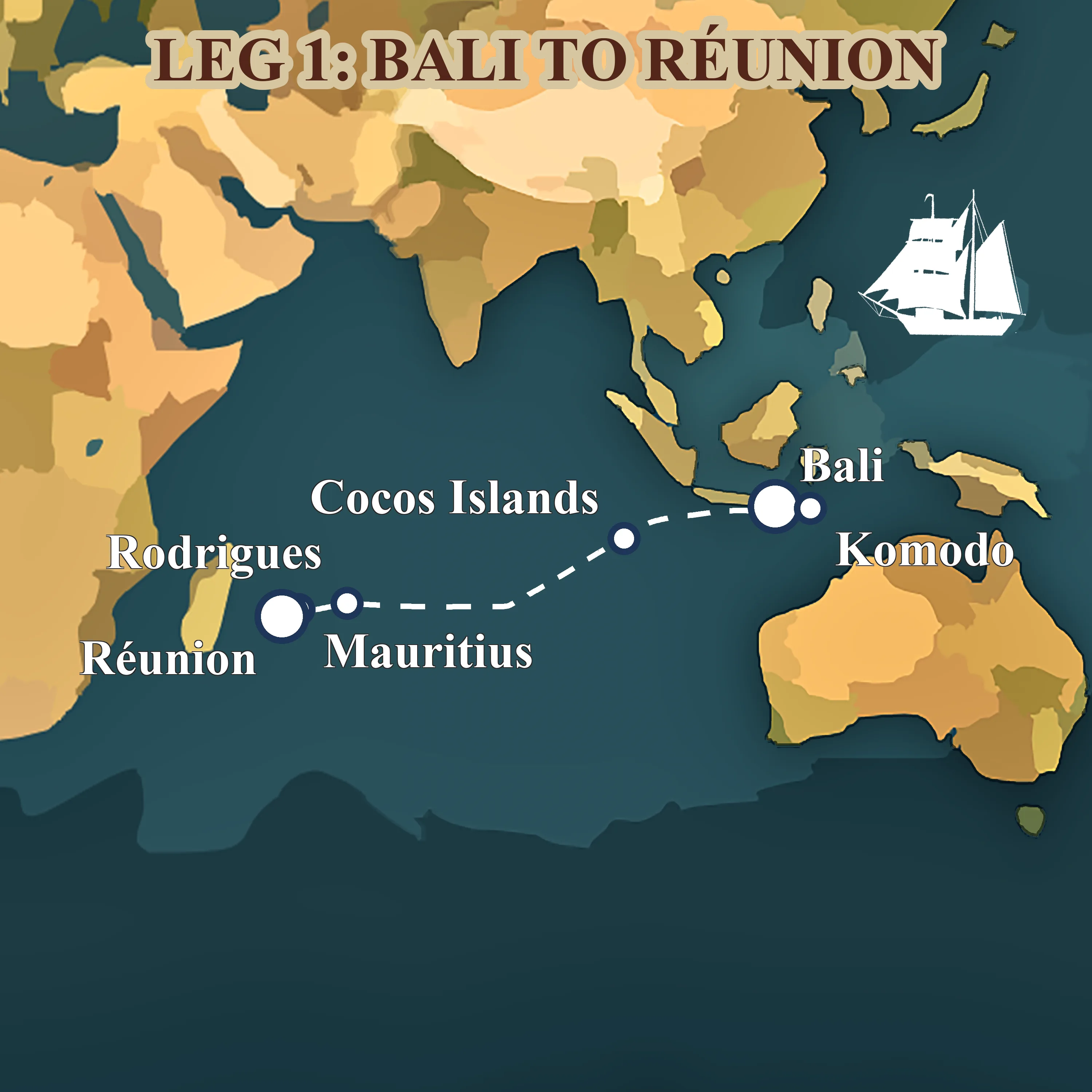
Leg 1: from Bali to Réunion across the Indian Ocean
May 2026 — Aug 2026 · Bali, Indonesia → Réunion, France
The opening chapter of Neptun's 482-day world voyage, a 4,078-nm trade-wind passage from the temples of Bali to the volcanic cliffs of Réunion.
Apply for Leg 4 → about Leg 1: from Bali to Réunion across the Indian Ocean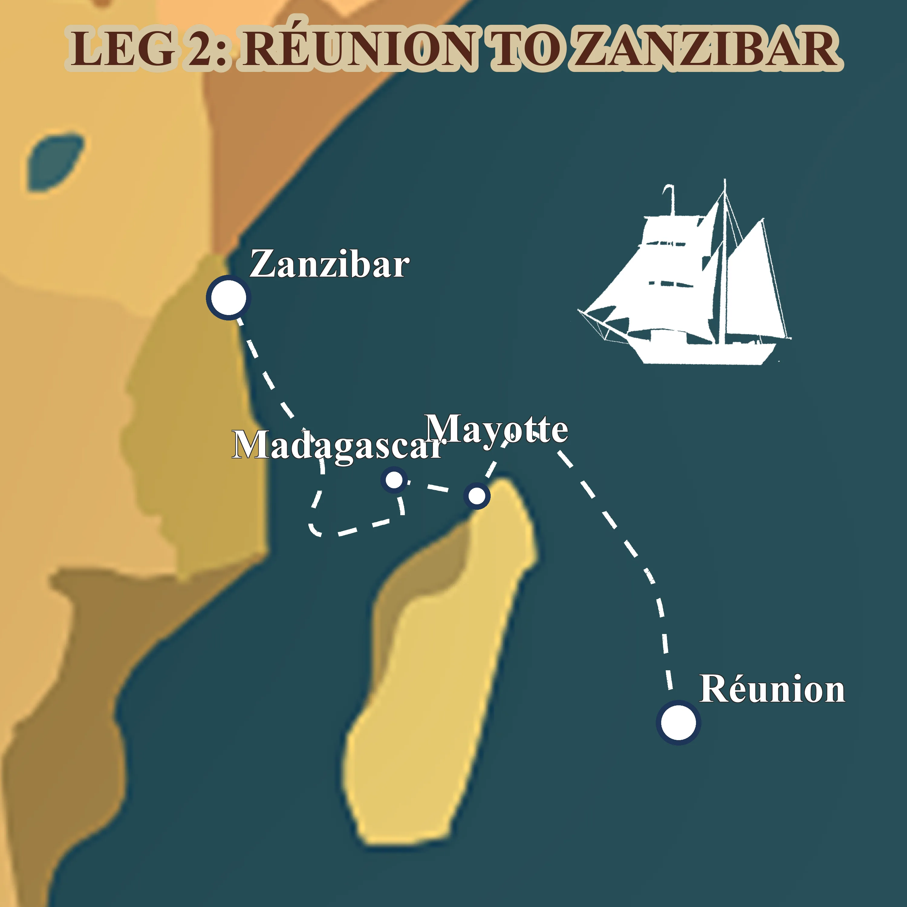
Leg 2: from Réunion to Zanzibar via Madagascar
Aug 2026 — Sept 2026 · Réunion, France → Zanzibar, Tanzania
Forty days across the western Indian Ocean, volcanic Réunion, lemur-haunted Nosy Be, the Mozambique Channel, and the spice-scented stone alleys of Zanzibar.
Apply for Leg 4 → about Leg 2: from Réunion to Zanzibar via Madagascar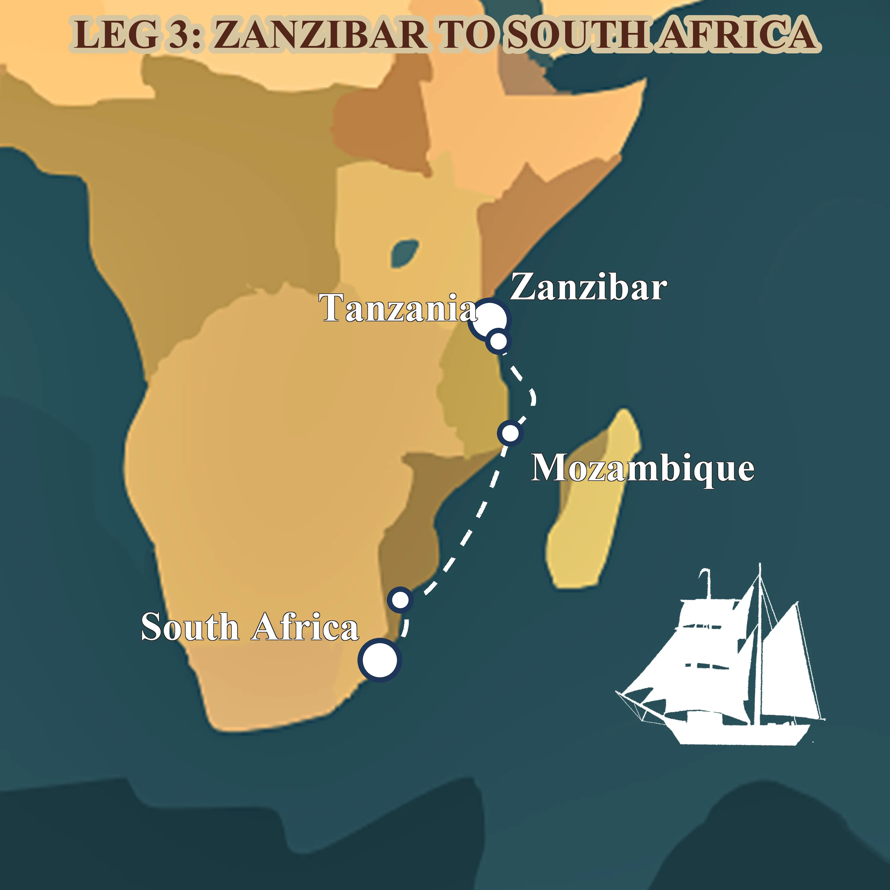
Leg 3: from Zanzibar to Durban down the Mozambique Channel
Sept 2026 — Nov 2026 · Zanzibar, Tanzania → Durban, South Africa
Sixty-three days coasting the African shore, spice islands, mangrove anchorages, Portuguese praças and the long trade-wind run down the Mozambique Channel to Durban.
Apply for Leg 4 → about Leg 3: from Zanzibar to Durban down the Mozambique Channel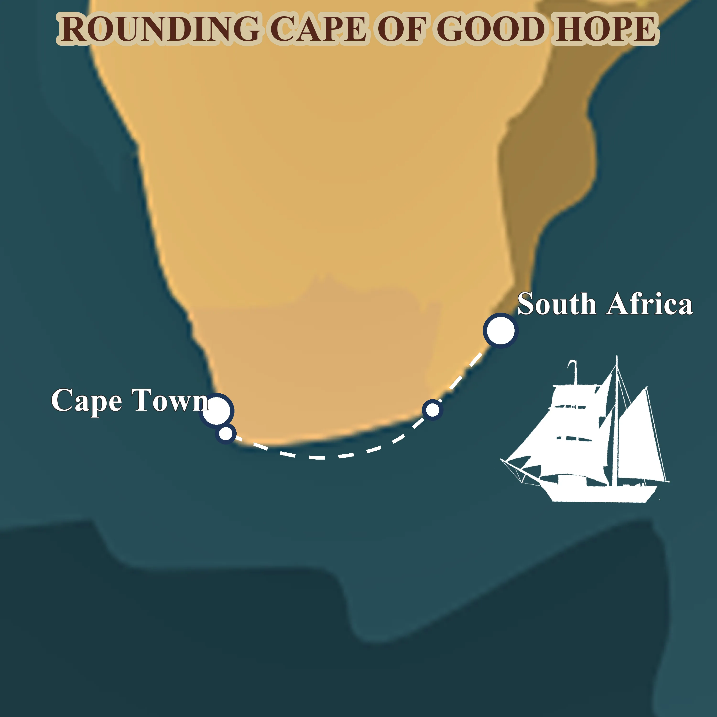
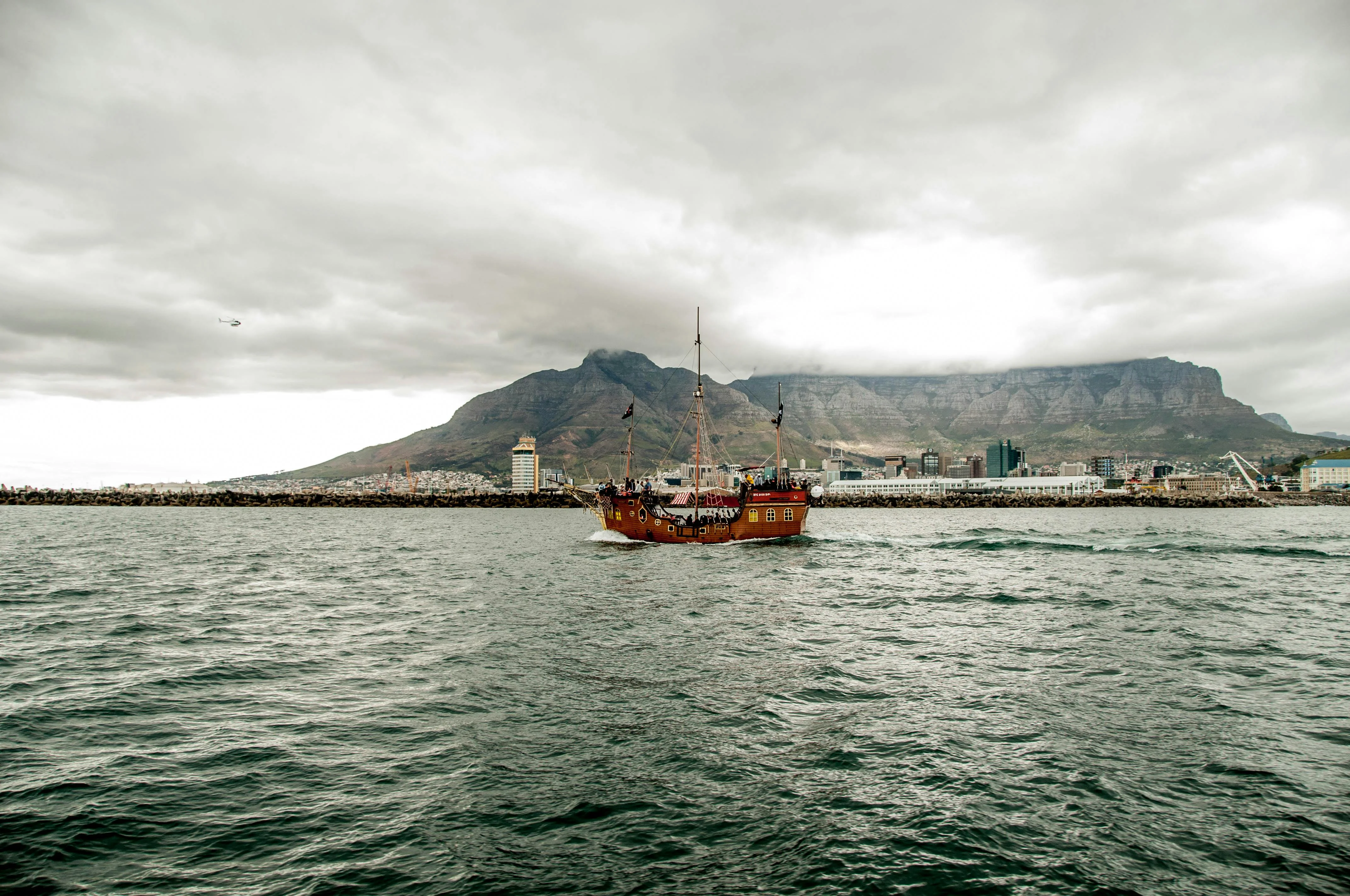
Leg 4: from Durban around the Cape of Good Hope
Nov 2026 — Dec 2026 · Durban, South Africa → Cape Town, South Africa
Thirty-eight days of serious seamanship, the Agulhas current, the Cape of Good Hope and the Southern Ocean at the tip of Africa, finishing quietly in Cape Town for Christmas.
Apply for Leg 4 → about Leg 4: from Durban around the Cape of Good HopeFreak waves: why SW wind against Agulhas current builds monsters
Wind-against-current wave steepening is not magic. A wave train travelling with an opposing current is effectively being compressed: the wavelength shortens, the height stays the same or grows, and the steepness, the ratio of height to length, goes up. Past a certain steepness the crest breaks. If two or three wave trains of slightly different periods arrive together, their peaks stack, and the compound wave can be much taller than any individual swell.
Along the Cape coast the ingredients arrive routinely. A two- or three-metre South Atlantic swell from the south-west meets a four-knot south-flowing current running into it. The swell tightens. On top of that you can get local wind sea from the SW gale itself, another one or two metres, shorter-period. When everything lines up, individual waves of fifteen to twenty metres, and in rare cases higher, have been recorded. The South African coast between East London and Cape Agulhas has the world's best documented history of this sort of sea. Merchant shipping built across the last century treats it as a known hazard.
There is no drama in this. It is physics that has been mapped for decades, and the mitigation is equally well understood: do not sit in the wind-against-current zone when the SW front comes through. That is the whole trade. Read the Leg 4 itinerary in full and you will see the stop in East London built in explicitly for exactly that reason, a five-day pause to let a front pass before committing to the 575-nautical-mile leg round the Cape.

Wind over current, the signature Cape sea
Weather routing: the only honest way to round the Cape
You do not fight a Cape passage. You wait for it. A good weather window has three ingredients, and all three need to line up before a tall ship commits to the 575-nautical-mile leg from East London to Cape Town.
First, a ridge of the South Atlantic high sitting over the Cape, giving light to moderate easterly or south-easterly winds in the lee of the coast. Second, no south-west cold front forecast to sweep through in the next forty-eight to seventy-two hours, that is the length of time it takes us to clear Cape Agulhas and put ourselves west of the worst of the wind-against-current zone. Third, an Agulhas forecast showing the current in its normal jet and no unusually deep warm-core eddies shed off to the west, which can extend the hazardous water much further offshore than usual.
The tools are the same as on any serious ocean passage: GRIB files from the GFS and ECMWF global models, marine forecasts from local authorities, the shipping reports, and, critically, a dedicated weather router working the passage from shore. NEPTUN uses professional weather routing for every committing leg of the world voyage, and the Cape passage is the one where it matters most.
What a router is actually reading
Read the high
Is the South Atlantic high ridging over the Cape, or sitting offshore? Position of the ridge tells you what the coastal winds will be.
Read the front
When does the next SW cold front arrive? Is there a 48–72-hour gap clear to Cape Agulhas? Front spacing varies with the season.
Read the current
Is the Agulhas running normally, or has it thrown off a large warm-core eddy? Eddies can extend the hazard zone far to the west.
Cape of Storms to Cape of Good Hope, the short history
The naming story is the best frame in the whole Cape literature. Bartolomeu Dias rounded the Cape in February 1488, the first European to do so by sea, and named it Cabo das Tormentas, the Cape of Storms. King John II of Portugal renamed it Cabo da Boa Esperança on the political theory that it opened the sea route to India. Vasco da Gama proved him right nine years later: Lisbon on 8 July 1497, the Cape itself on 22 November 1497, Calicut on 20 May 1498. The weather did not change between 1488 and 1497. The branding did. See Bartolomeu Dias and Vasco da Gama for the dates.
Every great age of sailing ships that followed treated the Cape as the second great ocean cape, after Cape Horn. The tea and wool clippers of the 1850s and 1860s raced Cape to Cape on the way home from Australia. The single-handed racers of the modern era, Robin Knox-Johnston first round non-stop in 1968-69, read exactly the same weather charts we do, with fewer tools. The big offshore races still use it as a tactical gate: round clean and you have the South Atlantic to yourself.
538 years of rounding
A short timeline of Cape passages
1488, Bartolomeu Dias names the Cabo das Tormentas
A Portuguese caravel, blown south in a gale, becomes the first European vessel to round the Cape from the west. Dias calls it the Cape of Storms. King John II renames it the Cape of Good Hope for political reasons.
1497, Vasco da Gama proves the India route
Leaves Lisbon on 8 July, clears the Cape on 22 November, arrives at Calicut on 20 May 1498. The westabout route to India is open, and the Cape becomes the busiest choke point on the planet for the next 400 years.
1850s, the clipper era
Tea and wool clippers race from Foochow and Sydney back to London via the Cape, pushing the westerlies south of 40°S for speed. The Cape is their last chance to rest before the final sprint up the Atlantic.
1968–69, Knox-Johnston rounds non-stop
Robin Knox-Johnston becomes the first person to sail single-handed, non-stop around the world. Suhaili rounds the Cape in the dead of the Southern Ocean winter and proves the modern solo era feasible.
Today, Vendée Globe, Ocean Race, tall ships
The Cape remains the second of three great capes on every southern-ocean circumnavigation. NEPTUN follows the classic westabout route round the Cape in Nov–Dec 2026.
What Leg 4 actually looks like on the chart
Abstractions only get you so far. Here is what the passage looks like concretely: 919 nautical miles, 38 total days, split into three uneven pieces. Durban to East London, 285 nautical miles, about 3.4 sail days, then six nights alongside. East London to Cape Town, 575 nautical miles, about 6.8 sail days, the commit passage round the Cape itself. Cape Town to Saldanha, 59 nautical miles, under a sail day, the quiet denouement after the rounding is done.
The East London stop is not decoration. It is five working days of preparation: a rig survey before the committing leg, storm canvas bent on in place of the light suits, life-raft and EPIRB serviced, the router working the window. When the window opens we leave; when it does not, we sit. That is the entire game. Leg 4: Durban to Cape Town carries the full day-by-day on the voyage page.
Leg 4 in numbers
Ready to round the Cape with us? Apply for a berth on Leg 4 and we will get you onto the crew list for Durban on 12 November 2026.
How a square-rigger rounds it differently from a yacht
A cruising yacht and a brigantine do not solve the Cape passage the same way. Three differences matter.
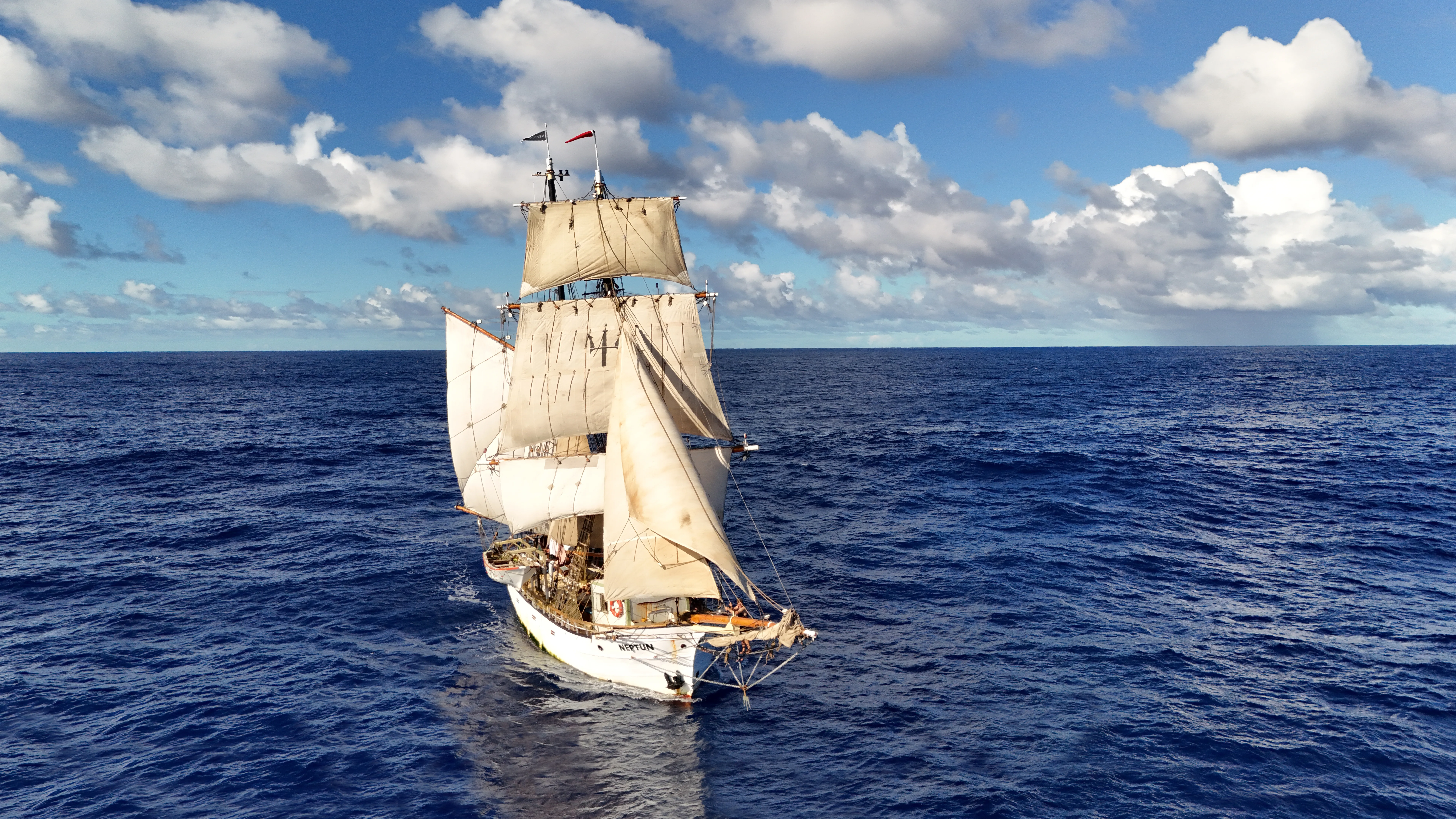
First, sail plan. A square-rigger has more options for balancing the ship in a rising wind than a sloop, you can strike the upper sails while keeping the fore-and-aft aft sails drawing, or heave-to under a close-reefed topsail and a trysail. That gives you more gears between "full sail" and "bare poles" than a yacht carries. On what a brigantine actually is we lay out the rig piece by piece.
Second, crew. Leg 4 sails with the professional crew plus ten trainees on a three-watch system. More hands means sail handling does not depend on electric winches or autopilots, which means it does not fail when the battery bank goes. And more hands means watches are four on, eight off, which keeps decision-making sharp across a long passage.
Third, window size. A fast yacht might sprint 180 nautical miles between fronts. We need a 550-nautical-mile window clear of the worst SW weather. That means we sit longer in East London, for a bigger gap, which is why the five prep days are built into the plan, not a luxury. The whole point of coming on Leg 4 is to learn traditional seamanship the way it is actually practised on long ocean passages.
FAQ
Sailing the Cape of Good Hope, common questions
How dangerous is rounding the Cape of Good Hope?
Dangerous in the wrong weather window, manageable in the right one. The hazard is the combination of a south-west front meeting the south-flowing Agulhas current, that is what produces the short, steep seas the Cape is known for. The mitigation is weather routing: a 48–72-hour window with no front forecast and the current in its normal jet. On a well-found ship with a competent router, it is a planned passage, not a gamble. More than a thousand wrecks on the coast are a matter of historical record; almost none involve boats that waited for the window.
Which is worse, Cape Horn or Cape of Good Hope?
Cape Horn is consistently harder. It sits further south, in colder water, with a longer Southern Ocean fetch and no land in the way to break the swell. The Cape of Good Hope is easier on average, but can produce short bursts of equally dangerous seas when a SW front meets the Agulhas current head-on. The two are not comparable on a single axis. Horn is a grinding test of endurance; the Cape is a tactical weather problem.
Why is it called the Cape of Good Hope and not the Cape of Storms?
Bartolomeu Dias rounded it in February 1488 and named it Cabo das Tormentas, the Cape of Storms, after the weather he met. King John II of Portugal renamed it Cabo da Boa Esperança because it opened the sea route to India and the Portuguese crown needed the voyage to sound marketable. The weather did not change. The branding did. [Vasco da Gama](https://en.wikipedia.org/wiki/Vasco_da_Gama) proved the reroute right nine years later by reaching Calicut in May 1498.
How fast is the Agulhas current?
The core of the current peaks at about five knots, with a core width of roughly 34 kilometres running along the 200-metre shelf-edge contour between Durban and Port Elizabeth. Net transport is of the order of 100 sverdrups, one of the strongest western-boundary currents on the planet, comparable to the Gulf Stream. Outside the core, the current drops off quickly and counter-eddies can run in the opposite direction.
What time of year is best for sailing around the Cape of Good Hope?
The Southern Hemisphere summer, November to March. Southerly and south-easterly winds dominate, cold fronts are spaced seven to ten days apart instead of three to five, and daylight runs to fourteen hours or more. Leg 4 departs Durban on 12 November 2026 and rounds the Cape in late November, the sweet spot of the season. Winter rounding is sailed, but by commercial ships and fully-crewed racers, not by choice.
Can a tall ship sail around the Cape of Good Hope?
Yes, and they have for 538 years. Every Portuguese India-man, every British East-India-man, every clipper on the Australia run, and every modern square-rig sail-training vessel from the Europa to the Picton Castle has rounded this Cape. NEPTUN does it in November–December 2026, as part of the full world voyage. The passage is not a technical obstacle for a working square-rigger, it is a weather-window problem, and weather-window problems are what a professional crew solves every day.
Do you need sailing experience to join the Cape rounding?
No. Leg 4 takes a mix of experienced sailors and complete beginners. Weather routing, rig handling, watchkeeping and the specific skills of a Cape passage are taught on board by the professional crew, that is the entire point of a sail-training voyage. What you bring is willingness; what you leave with is a rounded Cape and the beginnings of real ocean seamanship. [Apply for a berth](/apply-now) and we can talk through the fit.
Read also
- Leg 4: Durban to Cape Town, the leg this article supports, with full itinerary, pricing, and dates.
- World Voyage 2026, all four legs of the 2026 season.
- Parts of a tall ship, the vocabulary behind the rig handling on a Cape passage.
- Learn traditional seamanship, the broader skill set a leg like this teaches.
- What is a brigantine?, why the two-masted sail plan works for ocean passages.
- Apply for a berth, if the article did its job.
Want to sail with us? Brigantine NEPTUN is a non-profit training ship, every voyage takes 10 crew members through real ocean sailing, no experience needed. Apply for a berth on Leg 4 or read the Leg 4 itinerary first.
Ready to round the Cape?
Apply for Leg 4
Durban → East London → Cape Town → Saldanha. 919 nautical miles, 38 days, November–December 2026. Ten berths, all skill levels, taught on board.
All nine legs
The full world voyage
Leg 4 rounds the Cape, the rest of the voyage runs Indonesia to Mauritius, Cape Town to Brazil, and home across the Atlantic. Pick the leg that fits your dates.
Leg 1: from Bali to Réunion across the Indian Ocean
May 2026 — Aug 2026 · Bali, Indonesia → Réunion, France
The opening chapter of Neptun's 482-day world voyage, a 4,078-nm trade-wind passage from the temples of Bali to the volcanic cliffs of Réunion.
Read more about this leg → about Leg 1: from Bali to Réunion across the Indian OceanLeg 2: from Réunion to Zanzibar via Madagascar
Aug 2026 — Sept 2026 · Réunion, France → Zanzibar, Tanzania
Forty days across the western Indian Ocean, volcanic Réunion, lemur-haunted Nosy Be, the Mozambique Channel, and the spice-scented stone alleys of Zanzibar.
Read more about this leg → about Leg 2: from Réunion to Zanzibar via MadagascarLeg 3: from Zanzibar to Durban down the Mozambique Channel
Sept 2026 — Nov 2026 · Zanzibar, Tanzania → Durban, South Africa
Sixty-three days coasting the African shore, spice islands, mangrove anchorages, Portuguese praças and the long trade-wind run down the Mozambique Channel to Durban.
Read more about this leg → about Leg 3: from Zanzibar to Durban down the Mozambique ChannelLeg 4: from Durban around the Cape of Good Hope
Nov 2026 — Dec 2026 · Durban, South Africa → Cape Town, South Africa
Thirty-eight days of serious seamanship, the Agulhas current, the Cape of Good Hope and the Southern Ocean at the tip of Africa, finishing quietly in Cape Town for Christmas.
Read more about this leg → about Leg 4: from Durban around the Cape of Good Hope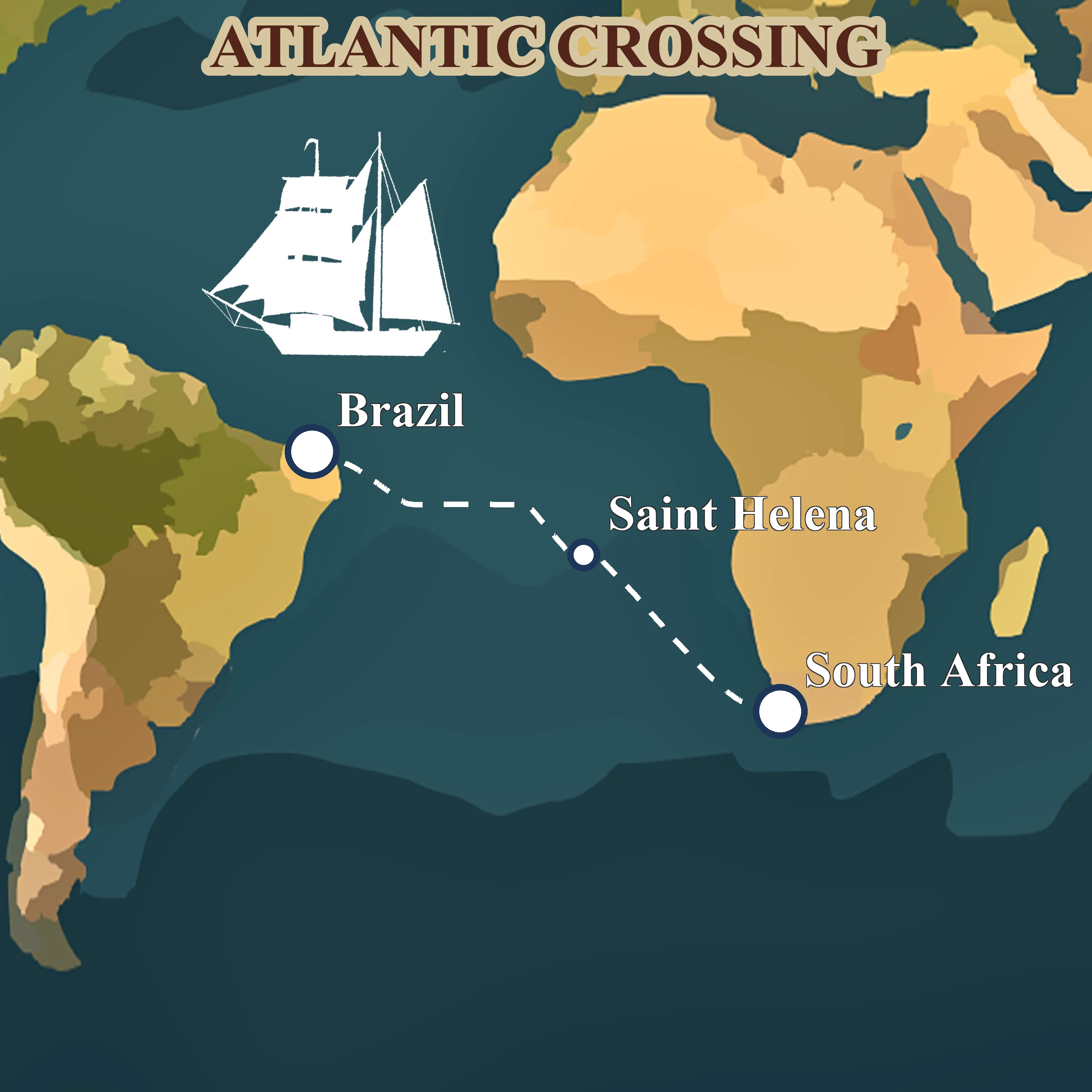
Leg 5: across the South Atlantic from Saldanha to Fortaleza
Jan 2027 — Mar 2027 · Saldanha Bay, South Africa → Fortaleza, Brazil
Forty-four days before the southeast trades, Napoleon's exile at St. Helena, the equator crossing, and landfall in tropical Brazil. The ocean chapter of the voyage.
Read more about this leg → about Leg 5: across the South Atlantic from Saldanha to Fortaleza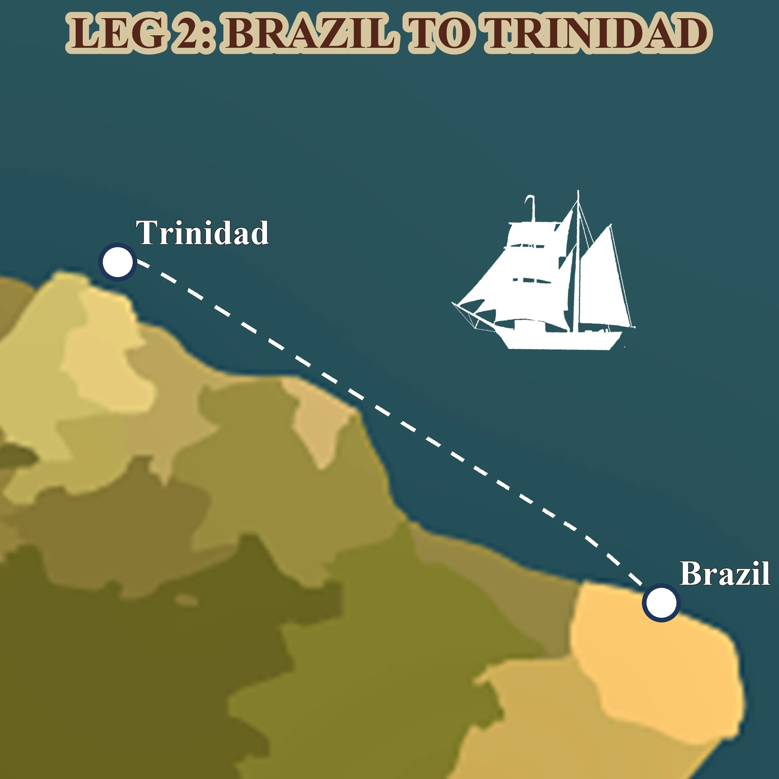
Leg 6: from Fortaleza to Trinidad along South America
Mar 2027 — Apr 2027 · Fortaleza, Brazil → Trinidad
A thousand miles of downwind trade running, the Amazon's brown water under the hull, the Guianas smudged on the horizon, and Trinidad's steelpan waiting at the end.
Read more about this leg → about Leg 6: from Fortaleza to Trinidad along South America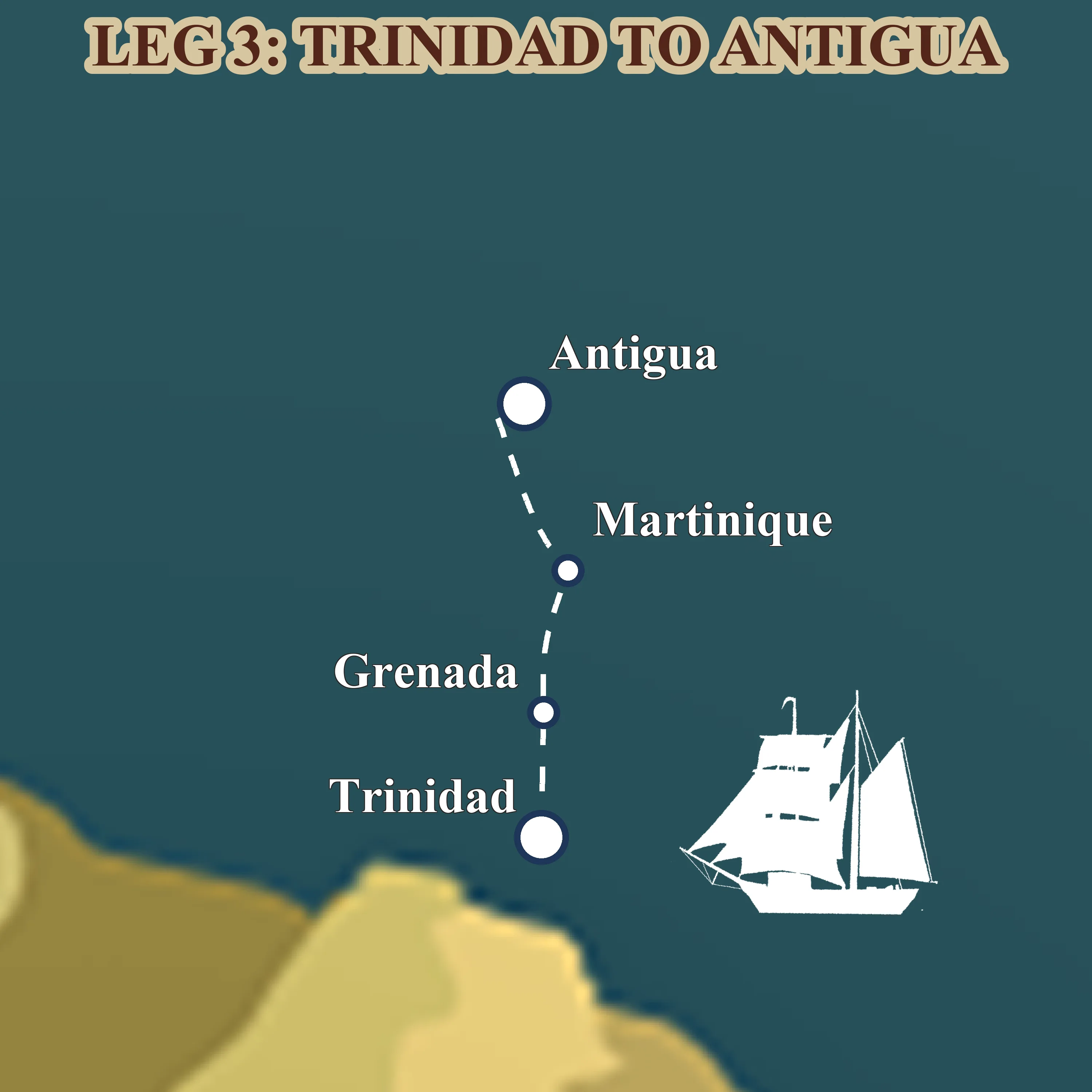
Leg 7: through the Windward Islands from Trinidad to Antigua
Apr 2027 — May 2027 · Trinidad → Antigua
Four weeks of short trade-wind daysails through the Lesser Antilles, turquoise anchorages, rum shops on the sand, French-Creole Martinique and the tall-ship scene in Antigua.
Read more about this leg → about Leg 7: through the Windward Islands from Trinidad to Antigua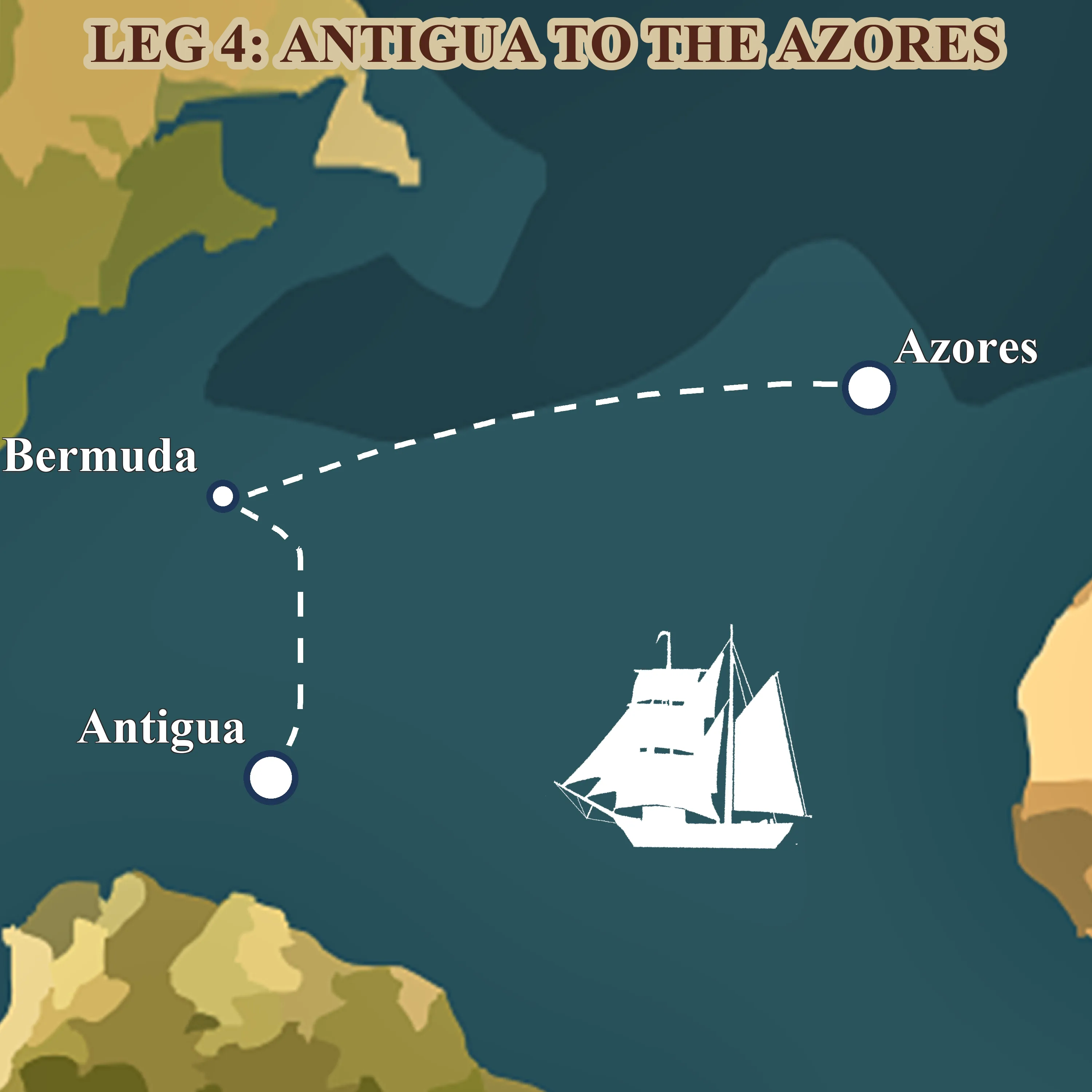
Leg 8: across the North Atlantic from Antigua to the Azores
May 2027 — Jul 2027 · Antigua → Ponta Delgada, Azores
Fifty-six days on the classic spring tall-ship route home, Antigua, a long reach to Bermuda's pink sand, then three weeks of open ocean to the volcanic Azores.
Read more about this leg → about Leg 8: across the North Atlantic from Antigua to the Azores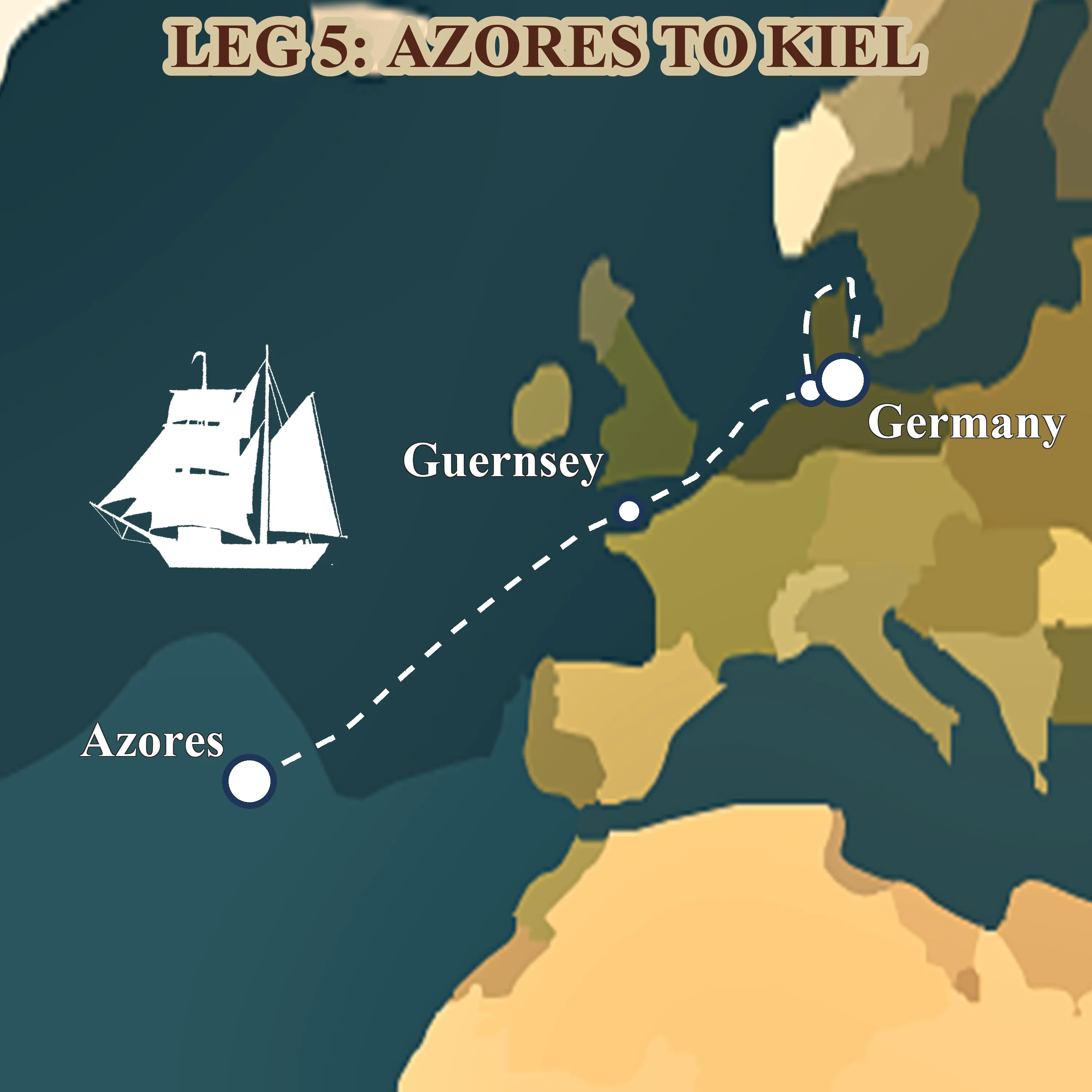
Leg 9: homecoming from the Azores to Kiel
Jul 2027 — Aug 2027 · Ponta Delgada, Azores → Kiel, Germany
The final 1,878 nm, from volcanic São Miguel to the Baltic, up the English Channel through the Dover TSS, past Helgoland's red cliffs and home to Kiel.
Read more about this leg → about Leg 9: homecoming from the Azores to Kiel