For roughly 400 years, every commercial sailing ship in the world set the same course across the same latitudes. That course is still there. Trade winds sailing is the reason we can plan a 482-day voyage across three oceans and know, within a week, when we'll be where. The physics hasn't changed since the Portuguese caravels first worked it out in the 1400s.
This article explains the trade winds, the Intertropical Convergence Zone (the ITCZ, or doldrums), and the horse latitudes that bracket them, the three climate bands that together define every one of the classic sailing routes. It's the physics that shapes every one of NEPTUN's nine legs, and the reason the route home from Bali to Kiel is the one it is.
See these routes on a real ship
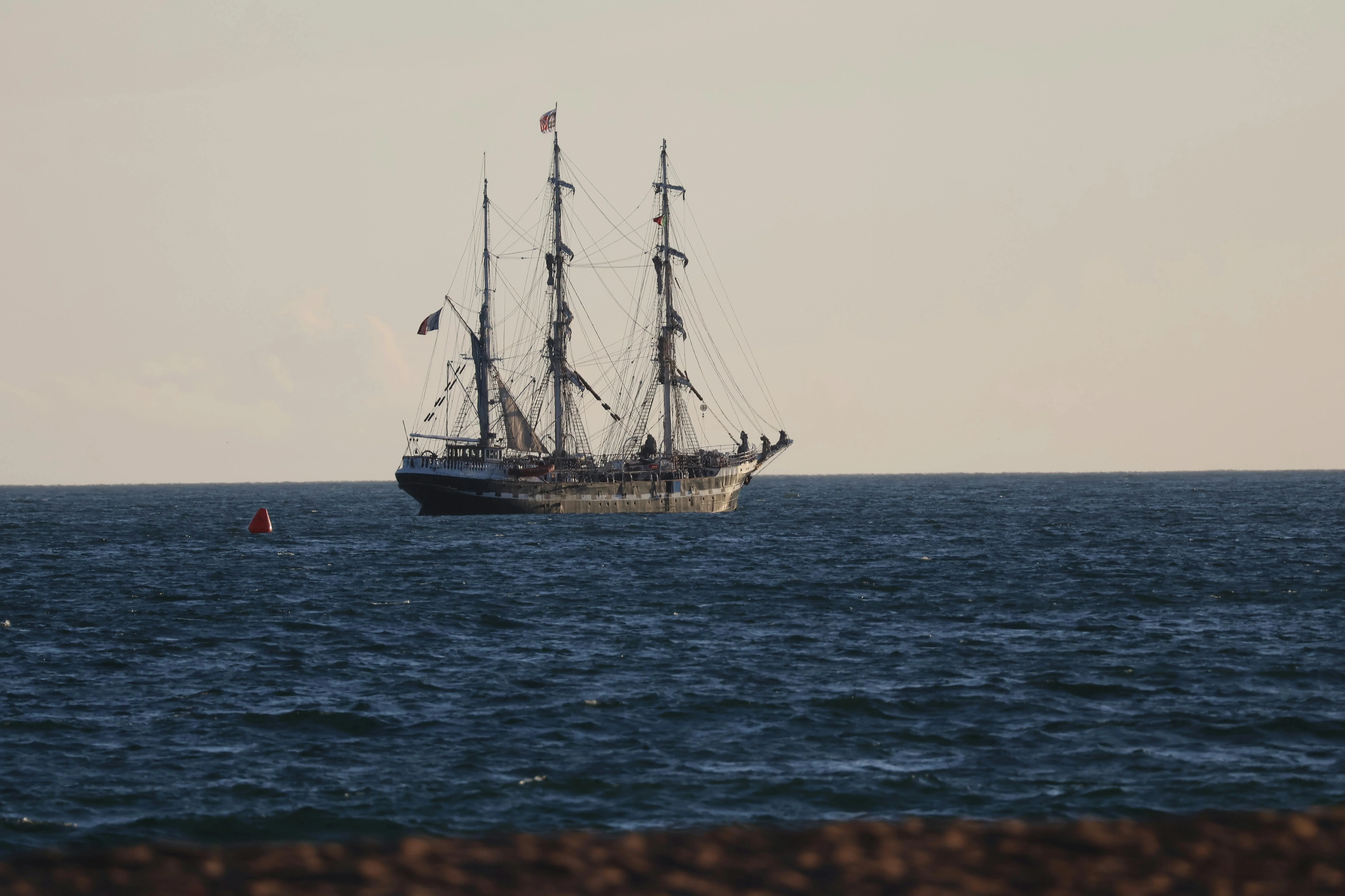
NEPTUN sails the classic trade-wind route across the Indian, South Atlantic, and North Atlantic oceans in 2026-2027.
On this page
- Why the trade winds exist
- The five wind belts of the world ocean
- The ITCZ: where the belts meet
- Why the classic route goes west-about
- How NEPTUN's 2026 legs ride the SE trades
- The 2027 return: NE trades, Azores High, and the climb home
- Reading the trades day-to-day onboard
- FAQ
- Read also
Why the trade winds exist
The trade wind belt is what you get when you heat a rotating planet unevenly. The sun pours most of its energy into the tropics. That hot air rises, and it has to go somewhere. It flows poleward at altitude, cools, sinks back down at around 30° north and 30° south, and then flows back toward the equator along the surface to replace the air that rose. That surface return flow is the trade winds.
The Earth's rotation deflects those flows. In the northern hemisphere, the return wind curves to the right and arrives from the northeast, the NE trades. In the southern hemisphere, it curves left and arrives from the southeast, the SE trades. Wind names come from where the wind comes from, not where it's going. A "northeast trade" blows out of the northeast, pushing a westbound ship along.
The whole system, rising air at the equator, poleward flow aloft, descending air at 30°, return flow along the surface, is called a Hadley cell, and it's remarkably stable. The US National Oceanic and Atmospheric Administration notes that the trades have been reliable enough for centuries of celestial-bearing commercial navigation. They aren't weather. They're climate.
The five wind belts of the world ocean
From the pole to the equator and back again, the world ocean is divided into five latitude bands. Each does something specific to a sailing ship.
| Band | Latitude | Wind direction | What a tall ship does here |
|---|---|---|---|
| Polar easterlies | 60°–90° | From the east | Avoided, ice, storms, darkness |
| Prevailing westerlies | 30°–60° | From the west | Fast east-bound passages (North Atlantic, Roaring Forties) |
| Horse latitudes | 25°–35° | Light, variable | Slow, sub-tropical highs, calms, heat |
| Trade winds | 5°–25° | NE or SE | The ocean-crossing workhorse, steady, warm, reliable |
| ITCZ / doldrums | ~5°N–5°S | Calm, squally | A belt you cross, not a belt you ride |
The horse latitudes sit at the descending limb of each Hadley cell, where the air that rose at the equator has cooled and is sinking. Sinking air warms, dries, and produces the subtropical high-pressure zones: the Azores High in the North Atlantic, the South Atlantic High off South America, the South Indian High south of Mauritius. The NOAA horse-latitudes reference explains the name, square-rigged ships stalled here for days, and desperate crews threw horses overboard to conserve water. We still plan to sail around these highs, not through them.
The prevailing westerlies are what you use for an east-bound passage, a North Atlantic crossing from the Azores to Europe, or a Southern Ocean run in the Roaring Forties. NEPTUN's final leg home from the Azores to Kiel uses these westerlies for the last stretch.
The trade winds themselves are where most of the ocean sailing happens. They are narrow (20° of latitude, roughly 1,200 nautical miles wide per hemisphere), steady (15–25 knots is typical), and warm. Shorts-and-t-shirts weather, a reef at night, following swell for weeks at a time. This is the climate band that how a brigantine uses square sails was evolved for, square rig thrives when the wind is abaft the beam and roughly the same for a fortnight.
The ITCZ: where the belts meet
The NE trades and the SE trades both blow toward the equator. They have to meet somewhere. Where they meet, the air has nowhere to go but up, which means calms at the surface, towering cumulonimbus above, and the weather for which the doldrums have been cursed by sailors since the word entered the language in the 1800s.
The Intertropical Convergence Zone, ITCZ in the shipping forecasts, doldrums in the logbooks, is narrow, a few hundred nautical miles across. A well-timed crossing takes three or four days. A badly-timed one can take two weeks of motor-sailing through calms and squalls. The Wikipedia entry on the ITCZ covers the meteorology; what matters to a sailor is two practical points.
First, the ITCZ migrates. It doesn't sit on the equator. The zone follows the sun's thermal peak. In boreal summer (May–September) it sits around 5–10°N in the Atlantic, drifting further north over land where the Sahara heats up. In boreal winter (November–March) it drops south, in some longitudes crossing the equator. Sailors read the latest analysis charts and pick the longitude where the ITCZ is narrowest at the time of year they're crossing.
Second, the ITCZ is squally but it's not dramatic. It's slow, muggy, wet, and frustrating. Squalls arrive fast, drop 30 knots for ten minutes, then leave a flat calm behind. Yachting World's doldrums guide is a good layman's overview. Experientially, as Ocean Navigator's crossing-the-doldrums account describes, you get good at reading the radar, you reef the square sails aloft before the squall hits, and you keep the boat moving through any breath of wind you can find. A square-rigger with all the parts of a tall ship working together handles the sudden squalls well, you can spill wind from the yards faster than you can re-trim a fore-and-aft sail.
How long does it take to sail through all this?
The trade-wind belts, the ITCZ crossings, the horse latitudes, they all add up to a predictable voyage length.
Why the classic route goes west-about
The single most counterintuitive thing about ocean sailing under canvas is this: you sail round the world by going the long way. The direct route east-about from Europe, up the Channel, down through the Med, through Suez, across the Indian Ocean, would be shorter on paper. No sailing ship does it. They all go west-about, and have for 500 years.
The reason is right there in the trade-wind diagram. In the tropics, the wind blows east-to-west. A westbound ship has it on the quarter or the stern for thousands of miles at a stretch. An eastbound ship fights it. The modern racing route, the Clipper Route round Cape Horn in the Roaring Forties, exists because racing yachts can point high enough to make the Southern Ocean westerlies work for an east-bound circuit. A square-rigged training ship cannot. The canonical reference for ocean route planning, Jimmy Cornell's World Cruising Routes, has been reissued every few years since 1987 and every edition still recommends the westabout trade-wind circuit for cruising boats.
The default westabout circuit has a name, the Milk Run. Panama → Marquesas → Tahiti → Fiji → Vanuatu → Australia → Indonesia → Cape Town → Caribbean → home. Roughly a year and a half, almost all of it downwind in the trades. For the full breakdown read the Milk Run, the classic westabout circumnavigation route; this article is the physics explainer, that one is the itinerary explainer.
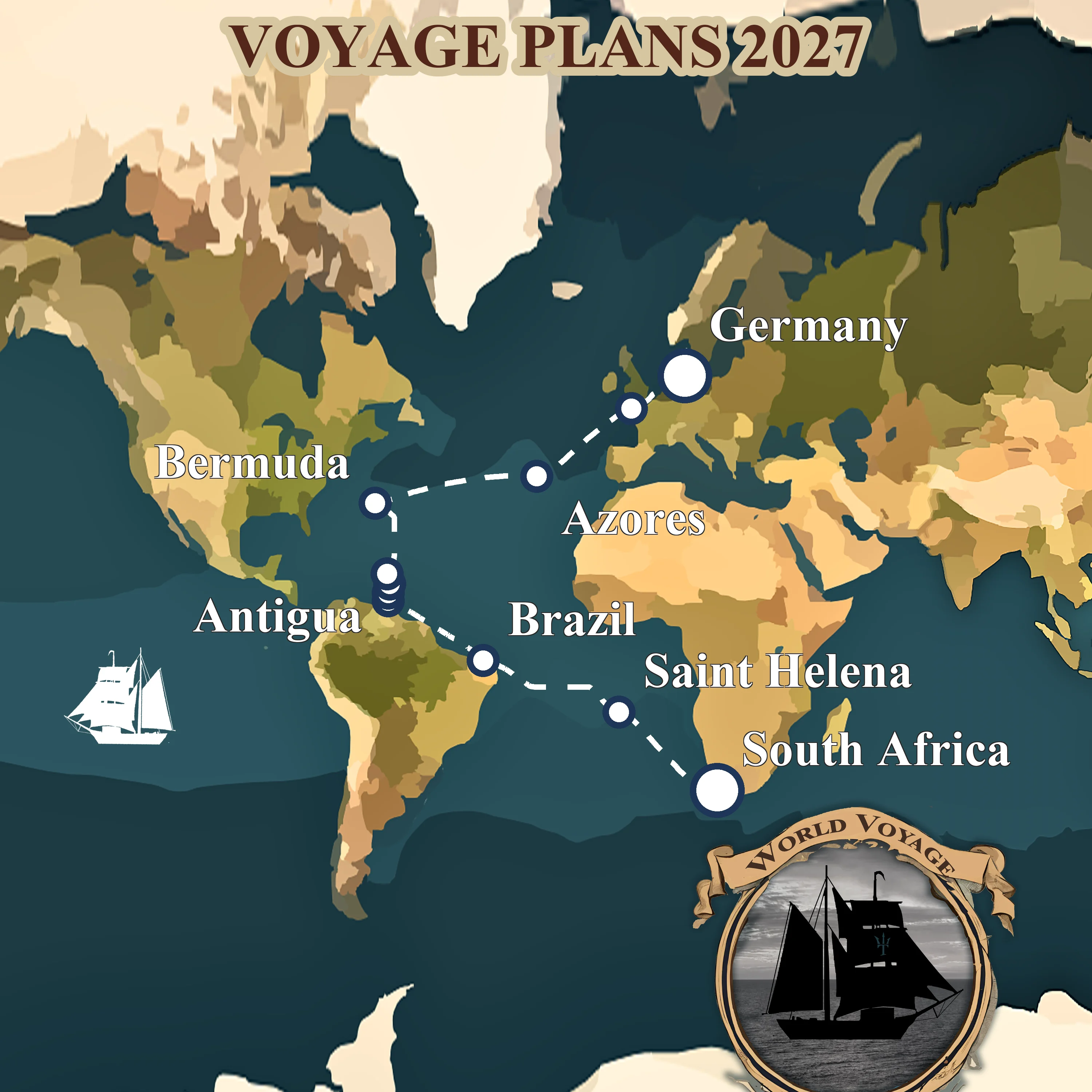
NEPTUN's 2026-2027 voyage is half a classic Milk Run, westabout, in the trades, but going round southern Africa instead of through Panama and the Pacific. The physics is identical. The next section walks through it leg by leg.
Curious how NEPTUN's route fits the classic pattern?
The leg-by-leg breakdown is next, each one is a trade-wind passage.
How NEPTUN's 2026 legs ride the SE trades
This is where the theory lands on a specific ship. NEPTUN's 2026 season is four legs from Bali to Brazil, every one of them inside a trade-wind belt. The 2026-2027 world voyage covers the whole arc; what follows is how the weather drives each leg individually.
Leg 1, Bali to Réunion (May–July 2026): the SE trades across the South Indian Ocean
Leg 1, Bali to Réunion across the Indian Ocean is the broadest, cleanest trade-wind reach on the entire voyage. The track runs across the 10°S–20°S band of the South Indian Ocean, right down the middle of the SE trade corridor, in the cyclone-free window of austral winter. The SE trades here are the most reliable of any trade-wind belt on the planet, 15–20 knots on the quarter for days on end, a long following swell, and a warm wake. Departure in May puts the ship across before the November cyclone season opens.
Leg 2, Réunion to Zanzibar (August 2026): SE trades plus the Mozambique Current
Leg 2, Réunion to Zanzibar via Madagascar stays in the same SE trade belt but adds a current that runs with you, the warm Mozambique Current flows south down the African coast, so running north on the Madagascar side of the channel gives the trades plus a favourable stream. A shorter leg, a fast leg, and it lands the ship at Zanzibar with the dhows in time for the October monsoon shift.
Legs 3 and 4 (skipped in this article)
Legs 3 and 4 round southern Africa, Zanzibar to Durban, then Durban to Cape Town. These are coastal passages dominated by the Agulhas Current and the South African weather systems, not by the trade winds. They get their own article. Trade-wind sailing resumes at Cape Town.
Leg 5, South Africa to Brazil (January–March 2027): the SE trades across the South Atlantic

Leg 5, across the South Atlantic from Saldanha to Fortaleza is a textbook use of a sub-tropical high. From Cape Town you head northwest, climbing the western flank of the South Atlantic High, the horse-latitude sub-tropical high of the South Atlantic. Once round the top of the high, the SE trades fill in and run you all the way to Brazil. This leg also does the first ITCZ crossing of the voyage, at about 5°N in the longitude of Fortaleza, exactly where the boreal-winter ITCZ sits. That's not luck; that's timing.
Leg 6, Brazil to Trinidad (March–April 2027): through the ITCZ into the NE trades

Leg 6, Fortaleza to Trinidad is the handoff. You start in the SE trades off Brazil, work through the ITCZ (narrow at this longitude, a few days to cross), and come out into the NE trades for the Caribbean. This is the only leg on the voyage where you experience both trade-wind belts and the calm band between them in a single passage, a concentrated lesson in every concept in this article.
Legs 7 and 8, the NE trades and the classic east-about return

Leg 7, the Windwards from Trinidad to Antigua is a short island-hop with the NE trades on the beam. Leg 8, Antigua to the Azores across the North Atlantic is the classic east-about North Atlantic return: climb north of the NE trade belt, arc east with the Azores High to starboard, pick up the prevailing westerlies for the last stretch. Yachting World's explainer by Chris Tibbs treats this exact arc as the canonical Atlantic return route, and Cruising World's "Talking Trade Winds" covers the same ground from the cruiser's perspective.
The trade-wind legs, pick one
Six of NEPTUN's nine legs run inside a trade-wind belt. Any of them is a complete trade-wind education in one passage.

Leg 1: from Bali to Réunion across the Indian Ocean
May 2026 — Aug 2026 · Bali, Indonesia → Réunion, France
The opening chapter of Neptun's 482-day world voyage, a 4,078-nm trade-wind passage from the temples of Bali to the volcanic cliffs of Réunion.
Read more about this leg → about Leg 1: from Bali to Réunion across the Indian Ocean
Leg 2: from Réunion to Zanzibar via Madagascar
Aug 2026 — Sept 2026 · Réunion, France → Zanzibar, Tanzania
Forty days across the western Indian Ocean, volcanic Réunion, lemur-haunted Nosy Be, the Mozambique Channel, and the spice-scented stone alleys of Zanzibar.
Read more about this leg → about Leg 2: from Réunion to Zanzibar via Madagascar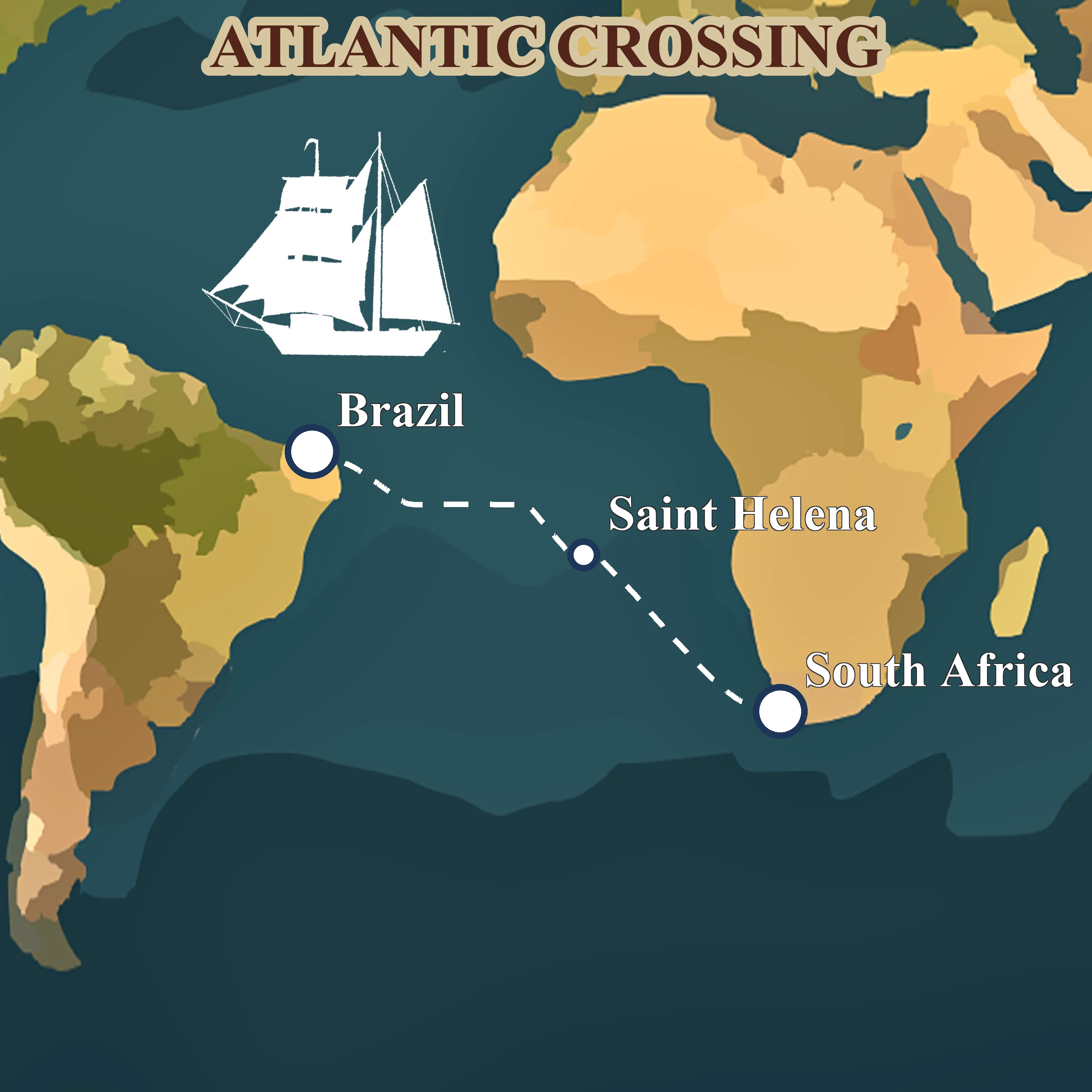
Leg 5: across the South Atlantic from Saldanha to Fortaleza
Jan 2027 — Mar 2027 · Saldanha Bay, South Africa → Fortaleza, Brazil
Forty-four days before the southeast trades, Napoleon's exile at St. Helena, the equator crossing, and landfall in tropical Brazil. The ocean chapter of the voyage.
Read more about this leg → about Leg 5: across the South Atlantic from Saldanha to Fortaleza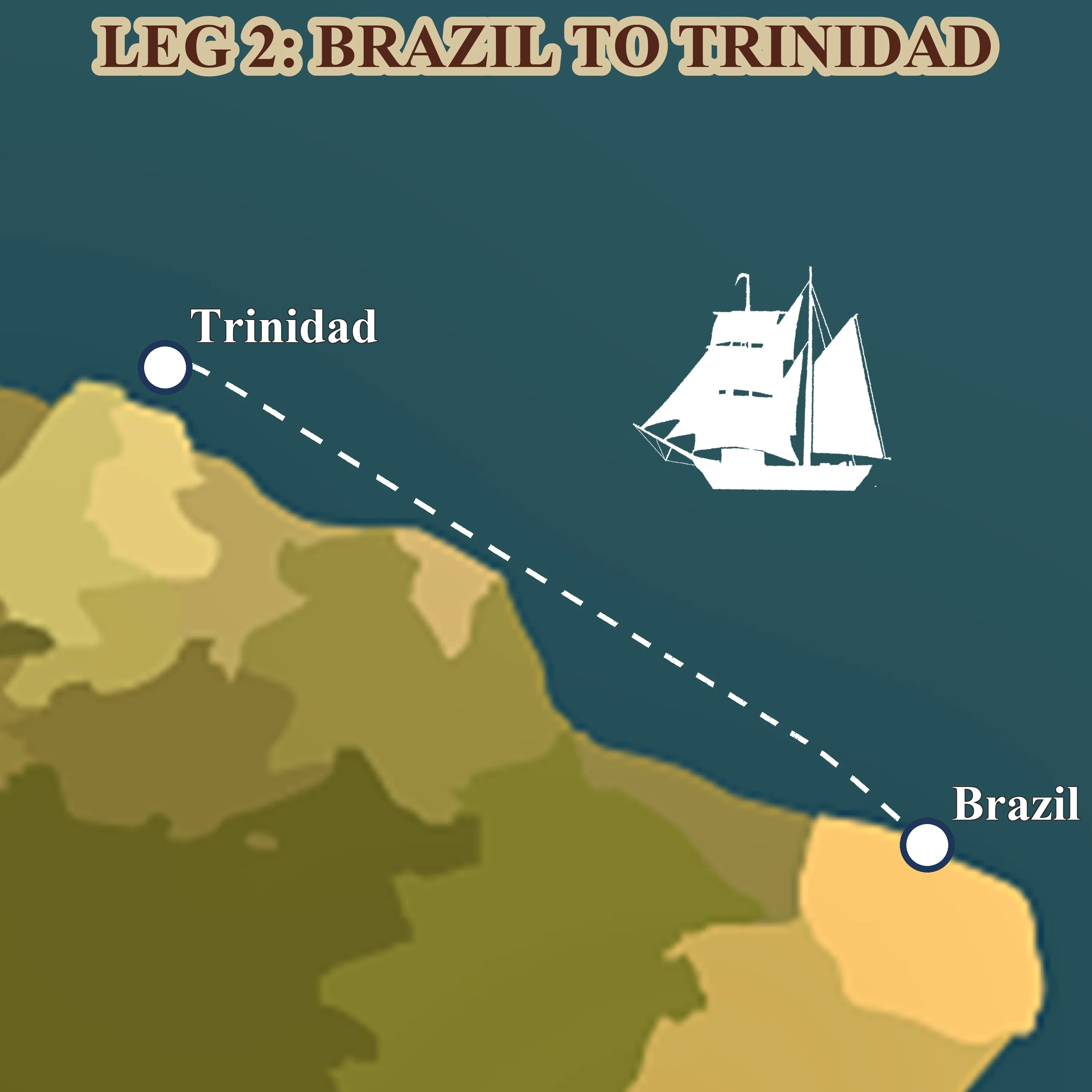
Leg 6: from Fortaleza to Trinidad along South America
Mar 2027 — Apr 2027 · Fortaleza, Brazil → Trinidad
A thousand miles of downwind trade running, the Amazon's brown water under the hull, the Guianas smudged on the horizon, and Trinidad's steelpan waiting at the end.
Read more about this leg → about Leg 6: from Fortaleza to Trinidad along South America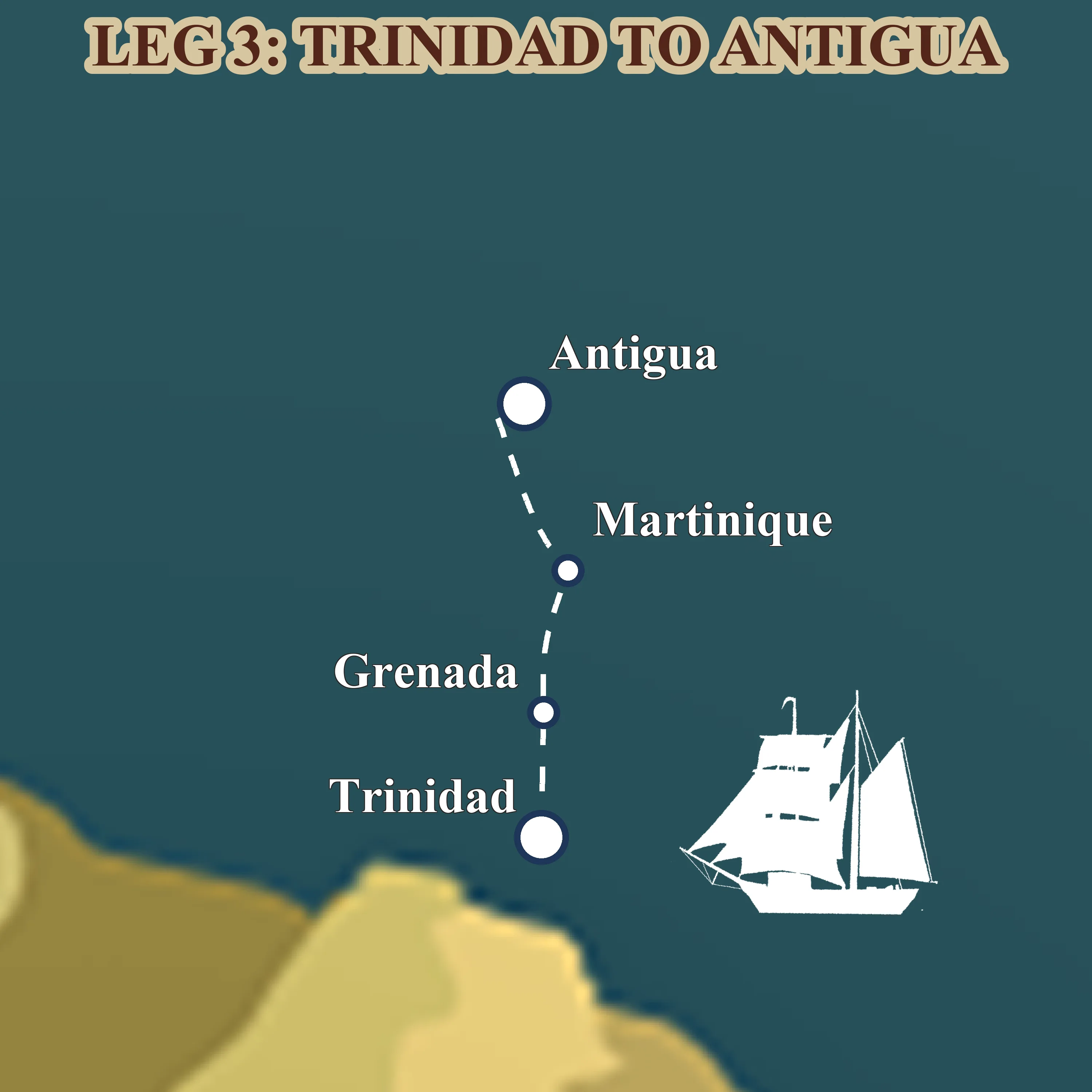
Leg 7: through the Windward Islands from Trinidad to Antigua
Apr 2027 — May 2027 · Trinidad → Antigua
Four weeks of short trade-wind daysails through the Lesser Antilles, turquoise anchorages, rum shops on the sand, French-Creole Martinique and the tall-ship scene in Antigua.
Read more about this leg → about Leg 7: through the Windward Islands from Trinidad to Antigua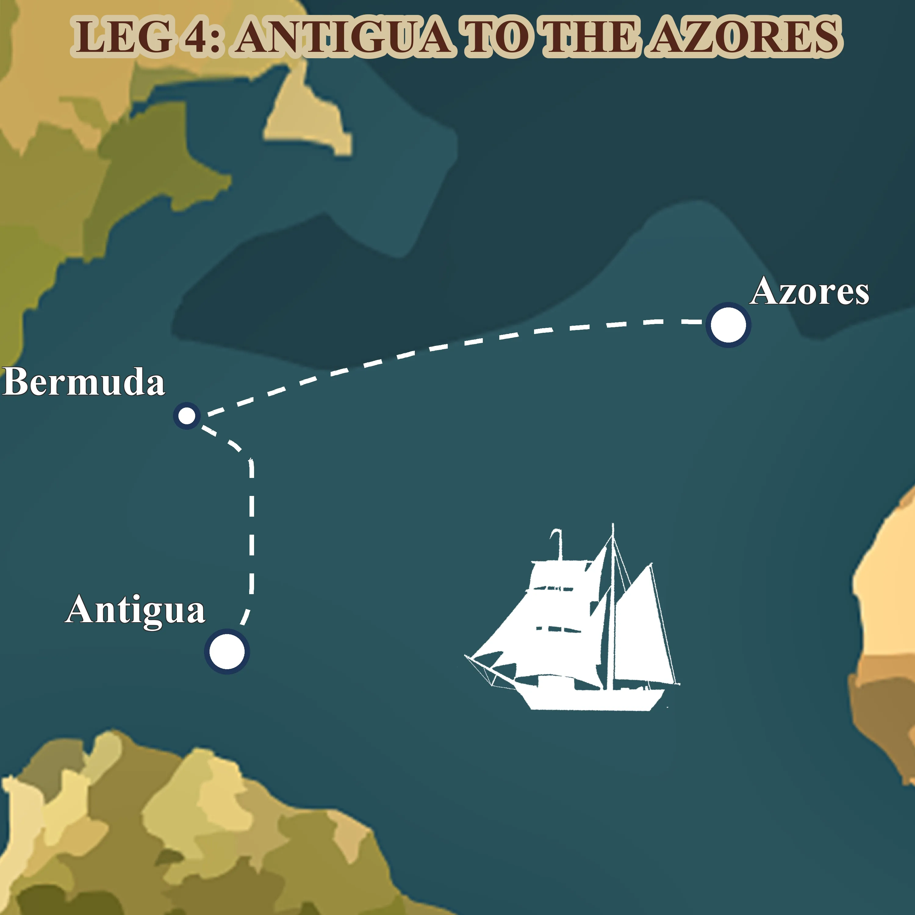
Leg 8: across the North Atlantic from Antigua to the Azores
May 2027 — Jul 2027 · Antigua → Ponta Delgada, Azores
Fifty-six days on the classic spring tall-ship route home, Antigua, a long reach to Bermuda's pink sand, then three weeks of open ocean to the volcanic Azores.
Read more about this leg → about Leg 8: across the North Atlantic from Antigua to the AzoresThese six legs are where the trades do the work
NEPTUN takes ten crew members per leg, no experience needed. If trade-wind sailing is why you're here, this is how you do it.
The 2027 return: NE trades, Azores High, and the climb home
The NE trades are the second half of the voyage, and they behave differently from the SE trades. They're narrower, more variable, and more sensitive to land, the Sahara heats up in boreal summer and pulls the ITCZ further north than its Atlantic average, which squeezes the NE trade band. The classic November–January window for a Canaries-to-Caribbean crossing is the best time to cross on the NE trades heading west; the reverse trip, west-to-east, asks you to climb north out of the trade belt entirely.
That climb is what Leg 8 does. You leave Antigua heading north-northeast, ride the NE trades while they last, then roll the dice on the northern edge of the Azores High. Sail around the high, not through it. The western flank gives you lifts from the south; the top gives you the westerlies. Leg 9, the last run from the Azores to Kiel, is fully out of the trades and in the prevailing-westerlies belt, with North Sea and Channel weather to finish.
That's why a westabout circumnavigation takes 18 months and an eastabout racing run takes 3, the Milk Run is about working with the trades; the Clipper Route is about outrunning them.
The Milk Run explained
The westabout trade-wind circumnavigation that every cruising sailor knows by name, and why NEPTUN's route is half of it.
Reading the trades day-to-day onboard
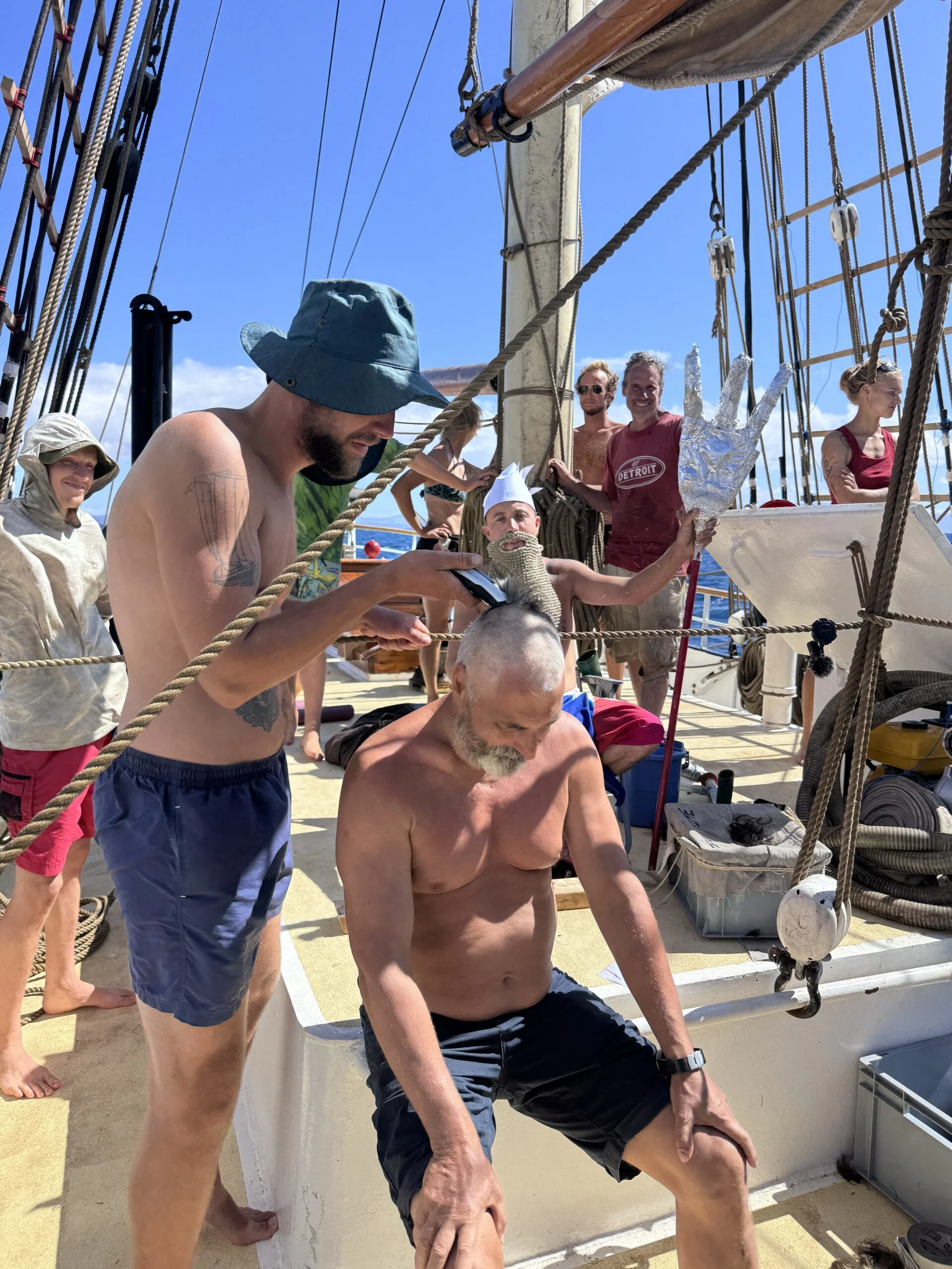
Abstract physics lands differently once you're in it. A trade-wind passage feels like this: 15–25 knots on the quarter for two weeks. The boat rolls downwind with a long, slow period, not unpleasant, but constant. The sun is hot by 09:00 and brutal by noon; everyone lives in shorts and t-shirts on watch, oilskins stay in the locker. At night you pull a reef before going off watch, not because the wind is likely to build but because it's simpler to drop a reef the next morning than to set one at 02:00 in a squall.
You learn to read a few things. The swell direction tells you the wind's been holding for days. A drop in the barometer plus the first high cirrus streaking in from a new direction means the trades are breaking down, probably a tropical wave, maybe a front. When you're approaching the ITCZ you start seeing tall cumulus where there were only fair-weather cotton-balls before, and the swell confuses, now coming from two directions as the NE and SE trade swells both reach you. The horizon starts showing squall lines at dusk. That's when the watch captain starts watching the radar every ten minutes and the deck crew learns what a brigantine actually is by taking the royals in at 03:00.
The calms of the ITCZ are what you've read about, glassy water, no horizon, a sun so close you can feel it on the back of your neck. It looks like this:
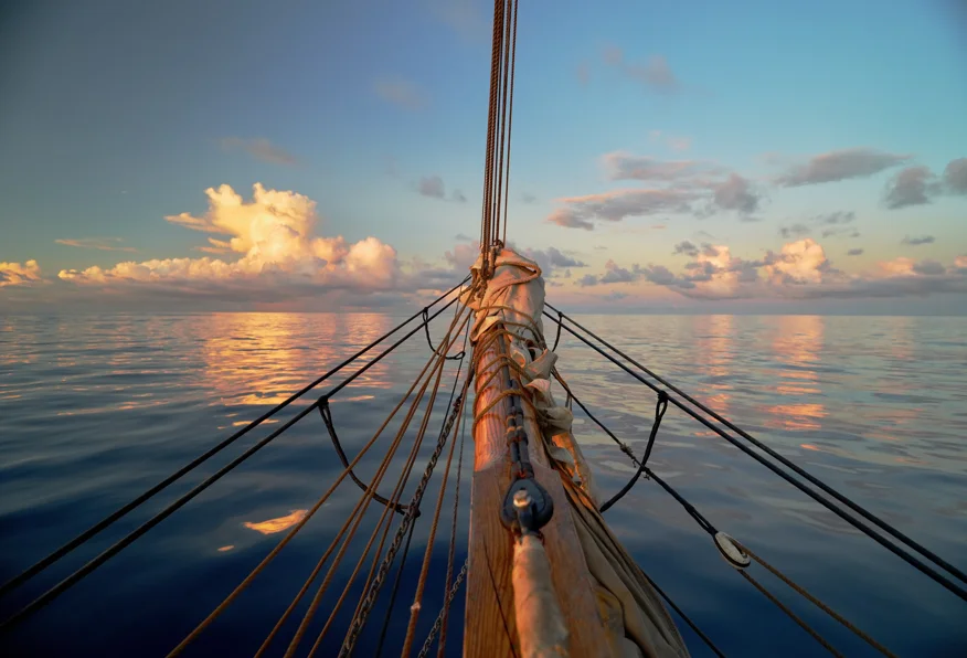
A day like that, and then a squall, and then another calm, and then the new trade-wind hemisphere, the SE to NE handoff or the NE to SE handoff, arrives as a line of darker water with ripples on it. You trim the yards, bear away onto the new quarter, and the passage starts again.
The full voyage, 482 days, three oceans
Every one of NEPTUN's nine legs, from Bali to Kiel.
Leg 1: from Bali to Réunion across the Indian Ocean
May 2026 — Aug 2026 · Bali, Indonesia → Réunion, France
The opening chapter of Neptun's 482-day world voyage, a 4,078-nm trade-wind passage from the temples of Bali to the volcanic cliffs of Réunion.
Read more about this leg → about Leg 1: from Bali to Réunion across the Indian OceanLeg 2: from Réunion to Zanzibar via Madagascar
Aug 2026 — Sept 2026 · Réunion, France → Zanzibar, Tanzania
Forty days across the western Indian Ocean, volcanic Réunion, lemur-haunted Nosy Be, the Mozambique Channel, and the spice-scented stone alleys of Zanzibar.
Read more about this leg → about Leg 2: from Réunion to Zanzibar via Madagascar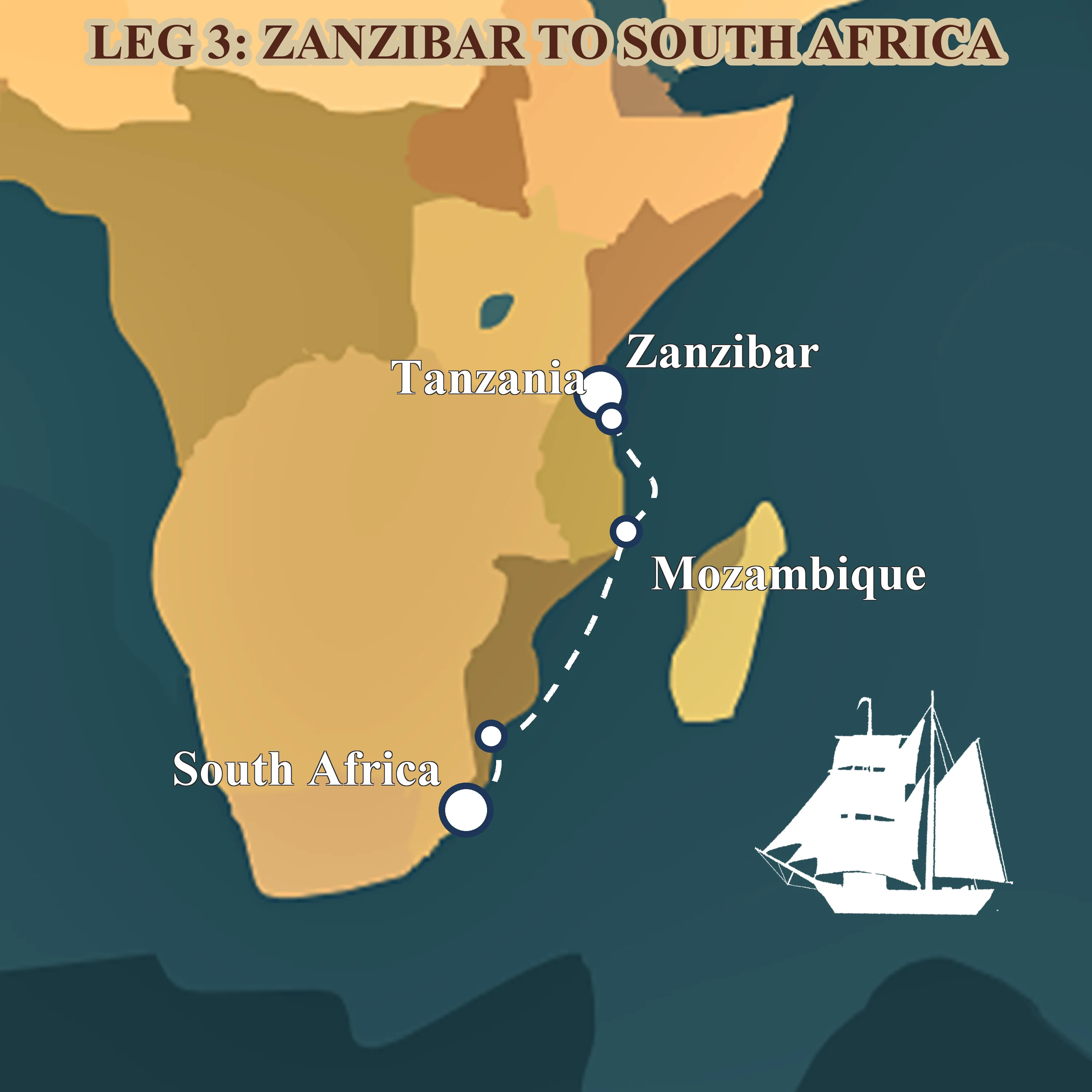
Leg 3: from Zanzibar to Durban down the Mozambique Channel
Sept 2026 — Nov 2026 · Zanzibar, Tanzania → Durban, South Africa
Sixty-three days coasting the African shore, spice islands, mangrove anchorages, Portuguese praças and the long trade-wind run down the Mozambique Channel to Durban.
Read more about this leg → about Leg 3: from Zanzibar to Durban down the Mozambique Channel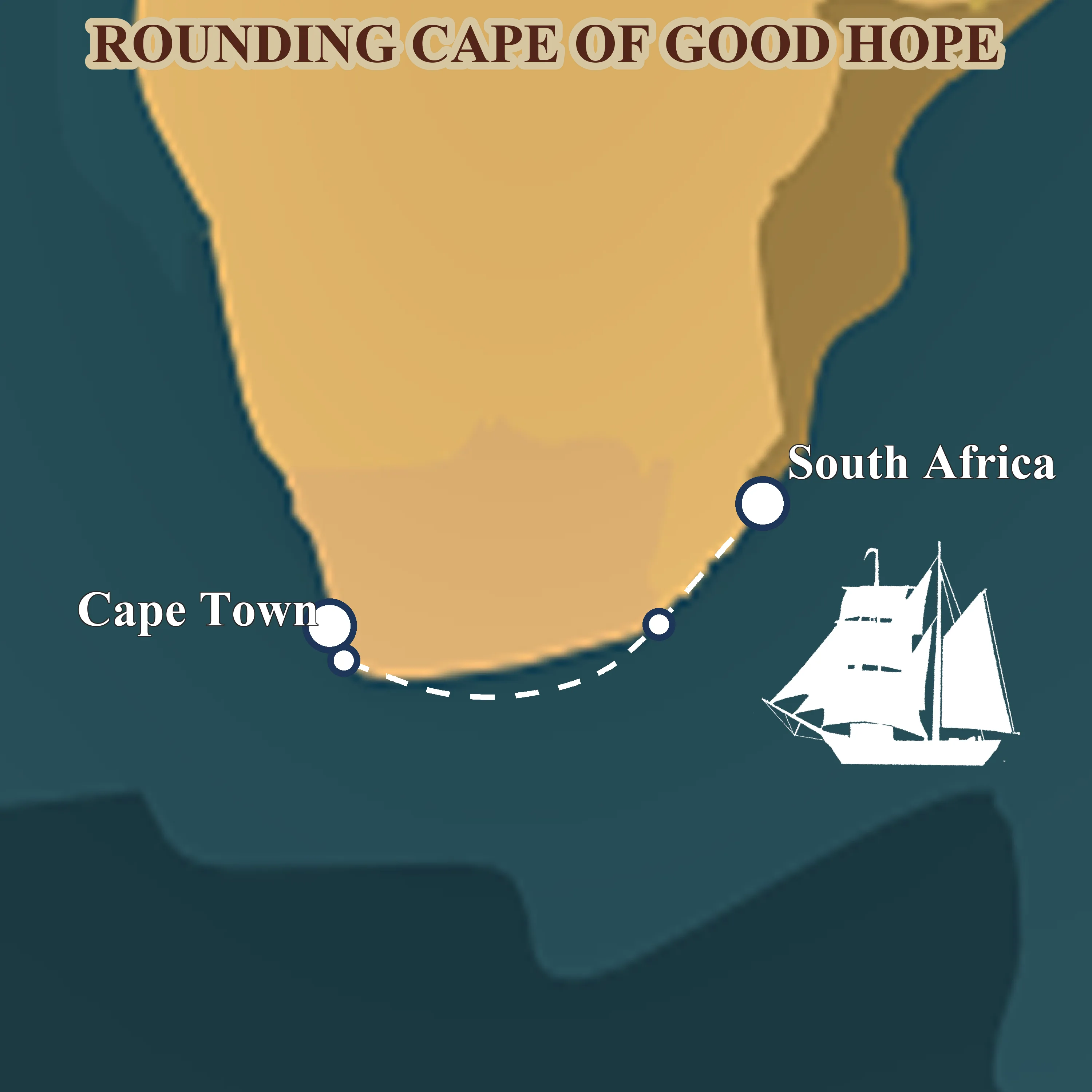
Leg 4: from Durban around the Cape of Good Hope
Nov 2026 — Dec 2026 · Durban, South Africa → Cape Town, South Africa
Thirty-eight days of serious seamanship, the Agulhas current, the Cape of Good Hope and the Southern Ocean at the tip of Africa, finishing quietly in Cape Town for Christmas.
Read more about this leg → about Leg 4: from Durban around the Cape of Good HopeLeg 5: across the South Atlantic from Saldanha to Fortaleza
Jan 2027 — Mar 2027 · Saldanha Bay, South Africa → Fortaleza, Brazil
Forty-four days before the southeast trades, Napoleon's exile at St. Helena, the equator crossing, and landfall in tropical Brazil. The ocean chapter of the voyage.
Read more about this leg → about Leg 5: across the South Atlantic from Saldanha to FortalezaLeg 6: from Fortaleza to Trinidad along South America
Mar 2027 — Apr 2027 · Fortaleza, Brazil → Trinidad
A thousand miles of downwind trade running, the Amazon's brown water under the hull, the Guianas smudged on the horizon, and Trinidad's steelpan waiting at the end.
Read more about this leg → about Leg 6: from Fortaleza to Trinidad along South AmericaLeg 7: through the Windward Islands from Trinidad to Antigua
Apr 2027 — May 2027 · Trinidad → Antigua
Four weeks of short trade-wind daysails through the Lesser Antilles, turquoise anchorages, rum shops on the sand, French-Creole Martinique and the tall-ship scene in Antigua.
Read more about this leg → about Leg 7: through the Windward Islands from Trinidad to AntiguaLeg 8: across the North Atlantic from Antigua to the Azores
May 2027 — Jul 2027 · Antigua → Ponta Delgada, Azores
Fifty-six days on the classic spring tall-ship route home, Antigua, a long reach to Bermuda's pink sand, then three weeks of open ocean to the volcanic Azores.
Read more about this leg → about Leg 8: across the North Atlantic from Antigua to the Azores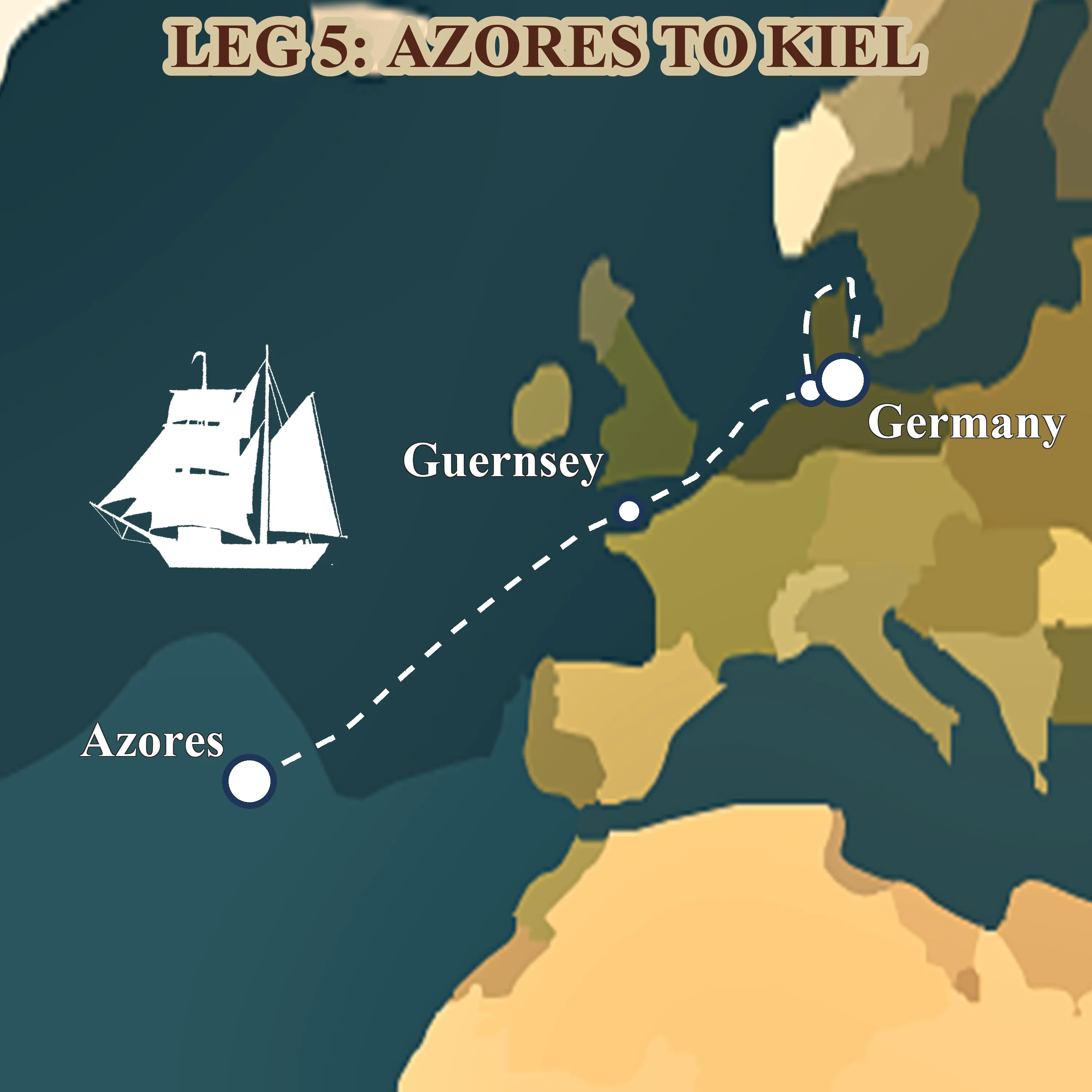
Leg 9: homecoming from the Azores to Kiel
Jul 2027 — Aug 2027 · Ponta Delgada, Azores → Kiel, Germany
The final 1,878 nm, from volcanic São Miguel to the Baltic, up the English Channel through the Dover TSS, past Helgoland's red cliffs and home to Kiel.
Read more about this leg → about Leg 9: homecoming from the Azores to KielFAQ
What are the trade winds in sailing?
The trade winds are the steady surface easterlies that blow between about 5° and 25° latitude in each hemisphere, the NE trades north of the equator, the SE trades south of it. They're caused by warm equatorial air rising and being replaced by surface air flowing in from the subtropics, deflected east-to-west by the Earth's rotation. Sailors use them for downwind ocean crossings under square sail.
What is the ITCZ, and why do sailors call it the doldrums?
The Intertropical Convergence Zone is the narrow belt where the NE and SE trades meet and the air rises. At the surface you get calms interrupted by towering squalls. "Doldrums" is the 19th-century sailors' word for the same band, sluggish, hot, unpredictable. The zone migrates north and south with the season, and crews read how the parts of a tall ship handle squalls before a crossing.
Why do sailors go west when sailing around the world?
Because the trade winds blow east-to-west in the tropics and the tropics cover most of the world's sailing weather. A westabout route puts the wind on the quarter or the stern for months at a time; an eastabout route fights it everywhere except the Southern Ocean. Cruising sailors use the classic Milk Run westabout route for exactly this reason, it's the path of least wind resistance.
When is the best time to cross the Atlantic by sail?
For a west-bound Canaries-to-Caribbean crossing, November through January, the NE trades are at their most reliable and the ITCZ sits furthest south. For an east-bound Caribbean-to-Europe crossing, April through June, the Azores High is stable and the westerlies to its north are working. NEPTUN's Leg 6, Brazil to Trinidad and Leg 8, Antigua to the Azores both fall inside these optimal windows.
What are the doldrums actually like on board?
Slow, hot, humid, and occasionally startling. Long calms where you drift, then a squall arriving as a wall of rain and thirty knots of wind for ten minutes, then another calm. Crews on Leg 5, the South Atlantic crossing cross the ITCZ near the end of the passage. It's uncomfortable, not dangerous, hot nights, the boat making a knot or two, and an intense smell of wet sails and ozone when the squalls have moved on.
Does NEPTUN use the trade winds on its 2026-2027 voyage?
Yes, six of NEPTUN's nine legs run inside a trade-wind belt. Leg 1, Leg 2, and the first half of Leg 5 ride the SE trades; the second half of Leg 5 plus Legs 6, 7, and 8 use the NE trades. Legs 3, 4, and 9 are in other wind systems (Agulhas coastal, Cape weather, North Atlantic westerlies). Browse the 2026-2027 world voyage to see each leg's weather window.
Read also
- How long does it take to sail around the world?, the time budget behind a westabout circumnavigation
- The Milk Run explained: the classic westabout circumnavigation, the sibling cornerstone for the route itself
- Square sails explained, the sail plan the trade winds were named for
- What is a brigantine? A complete guide, the ship type NEPTUN sails
- Our 2026–2027 world voyage, the nine legs, one by one
Want to sail the trade winds? Brigantine NEPTUN is a non-profit training ship, every voyage takes 10 crew members through real ocean sailing, no experience needed. Apply for a berth or browse the nine legs first.
Ready to sail the trade winds?
Ten crew per leg. No experience needed. Real ocean, real sail training, real trades.